|
search place name
|
||
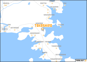
Takashiro (Miyagi, Japan)Takashiro is a town in the Miyagi region of Japan. An overview map of the region around Takashiro is displayed below.
regional and 3d topo map of Takashiro, Japan ::
Takashiro airports ::
The nearest airport is SDJ - Sendai, located 57.1 km south west of Takashiro.
Other airports nearby include GAJ - Yamagata (95.7 km west), HNA - Hanamaki (116.0 km north), AXT - Akita (171.5 km north west), Nearby towns ::
Nonohama (1.9km south) //
Onagawa (2.8km north west) //
Momonoura (3.4km south west) //
Orashuku (4.3km north west) //
Hamagurinohama (4.4km south west) //
Yagawa (5.7km south) //
Oginohama (5.7km south) //
Onmaehama (5.8km north) //
Sashigahama (6.4km north) //
Makinohama (7.0km south) //
Koamikurahama (7.5km south) //
Terama (6.1km east) //
Futsukiura (7.6km south) //
Wakehama (8.1km north) //
Tomarihama (8.6km south east) //
[all distances 'as the bird flies' and approximate] 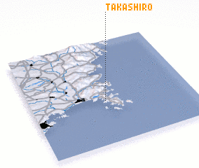 Places with similar names to Takashiro, Japan ::
// Takashur (RU)
// Takchura (RU)
// Tukhchar (RU)
// Diouka Tiaro (SN)
// Tak Shīrū (IR)
// Tucuchire (VE)
// Tŏkchae-ri (KP)
// Tŏkchae-ri (KP)
// Tŏkchi-ri (KP)
// Tŏkchi-ri (KR)
Disclaimer :: Information on this page comes without warranty of any kind |
||
|
Where is Takashiro? Elevation and coordinates ::
Latitude (lat): 38°25'0"N Longitude (lon): 141°28'0"E
Elevation (approx.): 110m (map arrows pan, magnifying glasses zoom) |
||
|
Visiting Takashiro? Hotel/Accommodation ::
Book a hotel in Takashiro Travel Guide ::
Buy a travel guide for Japan rental cars ::
car rental offers GPS waypoint ::
download a GPX waypoint (PoI) of Takashiro for your GPS receiver
|
||