|
search place name
|
||
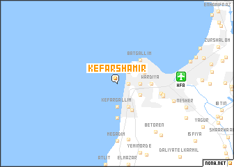
Kefar Shamir (Israel)Kefar Shamir is a town in Israel. An overview map of the region around Kefar Shamir is displayed below.
regional and 3d topo map of Kefar Shamir, Israel ::
Kefar Shamir airports ::
The nearest airport is HFA - Haifa, located 8.8 km east of Kefar Shamir.
Other airports nearby include RPN - Rosh Pina Mahanaim I Ben Yaakov (61.6 km east), SDV - Tel-aviv Sde Dov (77.6 km south), TLV - Tel-aviv Ben Gurion (87.7 km south), BEY - Beirut Rafic Hariri Intl (123.8 km north east), Nearby towns ::
El Kababīr (1.6km east) //
Sha‘ar Ha‘Aliya (2.4km north east) //
HaKarmel (3.1km east) //
Kefar Gallim (3.7km south) //
Ma‘bara (4.0km south east) //
Aẖuzzat Shemu‘el (3.6km south east) //
H̱efa (4.0km north east) //
Tirat Karmel (4.7km south east) //
Bat Gallim (4.8km north east) //
Wardiya (4.7km east) //
Hadar HaKarmel (4.7km east) //
HaH̱oterim (5.6km south) //
Newe Shaʼanan (6.2km east) //
Qiryat HaTekhniyyon (6.5km east) //
Ramot Remez (6.6km east) //
Bet Oren (9.3km south east) //
Ya‘arot HaKarmel (10.2km south east) //
[all distances 'as the bird flies' and approximate] 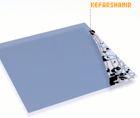 Places with similar names to Kefar Shamir, Israel ::
// Kafr Shamārah (EG)
Disclaimer :: Information on this page comes without warranty of any kind |
||
|
Where is Kefar Shamir? Elevation and coordinates ::
Latitude (lat): 32°48'0"N Longitude (lon): 34°57'0"E
Elevation (approx.): -32768m (map arrows pan, magnifying glasses zoom) |
||
|
Visiting Kefar Shamir? Hotel/Accommodation ::
Book a hotel in Kefar Shamir Travel Guide ::
Buy a travel guide for Israel rental cars ::
car rental offers GPS waypoint ::
download a GPX waypoint (PoI) of Kefar Shamir for your GPS receiver
|
||