|
search place name
|
||
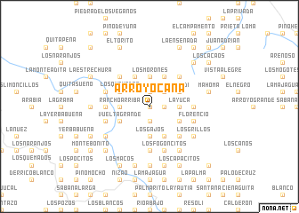
Arroyo Caña (Peravia, Dominican Republic)Arroyo Caña is a town in the Peravia region of Dominican Republic. An overview map of the region around Arroyo Caña is displayed below.
regional and 3d topo map of Arroyo Caña, Dominican Republic ::
Arroyo Caña airports ::
The nearest airport is STI - Santiago Cibao Intl, located 80.6 km north of Arroyo Caña.
Other airports nearby include SDQ - Santo Domingo Las Americas Intl (84.4 km east), BRX - Barahona Maria Montez Intl (89.4 km south west), POP - Puerto Plata Gregorio Luperon Intl (118.2 km north), LRM - La Romana Casa De Campo Intl (161.2 km east), Nearby towns ::
Arroyo Blanco (0.0km north) //
La Colonia (1.8km east) //
Arroyo Manteca (1.9km south) //
Juan Luis (1.9km north) //
Sauldí (2.6km north east) //
Los Gajos (3.7km south) //
Los Morones (3.7km north) //
Rancho Arriba (3.5km west) //
Banilejo (3.5km west) //
La Yuca (3.5km east) //
La Jina (4.1km north west) //
La Vigía (4.1km north west) //
La Trocha (4.1km south east) //
Arroyo Chiquito (4.1km south east) //
La Marca (4.1km south east) //
Derrumbado (4.1km south east) //
La Peñita (4.1km north east) //
Vuelta Grande (4.0km south west) //
Los Quemados (4.0km north west) //
Arroyo Prieto (4.0km south east) //
Suardí (4.0km north east) //
La Cañita (5.1km north west) //
El Yayal (5.1km north west) //
Derrumbadero de Mahoma (5.1km south east) //
El Perímetro (5.1km north east) //
La Nuez (5.3km east) //
La Marca (5.6km south) //
La Piedra (5.6km south) //
La Botella (5.6km south) //
[all distances 'as the bird flies' and approximate]  Places with similar names to Arroyo Caña, Dominican Republic ::
// Arroyo Iguana (MX)
// Arroyo Caña (DO)
// Arroyo Caña (DO)
// Arroyo Caña (DO)
// Arroyo Cano (DO)
// Arroyo Cano (DO)
Disclaimer :: Information on this page comes without warranty of any kind |
||
|
Where is Arroyo Caña? Elevation and coordinates ::
Latitude (lat): 18°42'0"N Longitude (lon): 70°25'0"W
Elevation (approx.): 723m (map arrows pan, magnifying glasses zoom) |
||
|
Visiting Arroyo Caña? Hotel/Accommodation ::
Book a hotel in Arroyo Caña Travel Guide ::
rental cars ::
car rental offers GPS waypoint ::
download a GPX waypoint (PoI) of Arroyo Caña for your GPS receiver
|
||