|
search place name
|
||
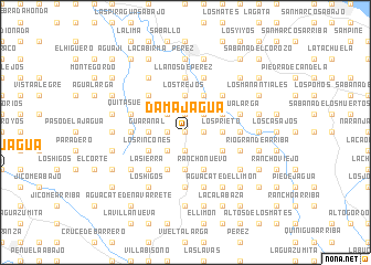
Damajagua (Puerto Plata, Dominican Republic)Damajagua is a town in the Puerto Plata region of Dominican Republic. An overview map of the region around Damajagua is displayed below.
regional and 3d topo map of Damajagua, Dominican Republic ::
Damajagua airports ::
The nearest airport is POP - Puerto Plata Gregorio Luperon Intl, located 28.8 km east of Damajagua.
Other airports nearby include STI - Santiago Cibao Intl (39.0 km south east), CAP - Cap Haitien Intl (142.8 km west), BRX - Barahona Maria Montez Intl (161.4 km south), SDQ - Santo Domingo Las Americas Intl (185.1 km south east), Nearby towns ::
Altamira (0.0km north) //
La Piedra (1.9km south) //
El Jamo (1.9km south) //
El Guayabo (1.9km south) //
La Atravesada (1.7km east) //
Higüero (1.7km west) //
Los Arroyos (1.9km north) //
La Guama (2.5km south west) //
La Jagua (2.5km south west) //
Los Llanos (2.5km south west) //
La Media Luna (2.5km north east) //
Las Aromas (2.5km north east) //
Las Lajas (2.5km north west) //
El Copey (3.7km south) //
Río Grande Abajo (3.5km east) //
Los Prieto (3.5km east) //
Guaranal (3.5km west) //
Quebrada Honda (3.7km north) //
Los Trejos (3.7km north) //
Bajabonico Arriba (3.7km north) //
El Mamey (4.1km south east) //
Rancho Nuevo (4.1km south east) //
El Alto del Fundo (4.0km south east) //
La Catalina (4.0km south east) //
El Túnel (4.1km south west) //
Estado (4.1km south west) //
Los Uveros (4.0km north east) //
Palmar Grande (4.0km north east) //
Hervidor (4.0km north east) //
[all distances 'as the bird flies' and approximate]  Places with similar names to Damajagua, Dominican Republic ::
Disclaimer :: Information on this page comes without warranty of any kind |
||
|
Where is Damajagua? Elevation and coordinates ::
Latitude (lat): 19°41'0"N Longitude (lon): 70°50'0"W
Elevation (approx.): 343m (map arrows pan, magnifying glasses zoom) |
||
|
Visiting Damajagua? Hotel/Accommodation ::
Book a hotel in Damajagua Travel Guide ::
rental cars ::
car rental offers GPS waypoint ::
download a GPX waypoint (PoI) of Damajagua for your GPS receiver
|
||