|
search place name
|
||
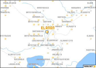
El Anón (Baoruco, Dominican Republic)El Anón is a town in the Baoruco region of Dominican Republic. An overview map of the region around El Anón is displayed below.
regional and 3d topo map of El Anón, Dominican Republic ::
El Anón airports ::
The nearest airport is BRX - Barahona Maria Montez Intl, located 16.8 km south east of El Anón.
Other airports nearby include PAP - Port-au-prince Toussaint Louverture Intl (117.4 km west), STI - Santiago Cibao Intl (129.4 km north east), SDQ - Santo Domingo Las Americas Intl (161.9 km east), POP - Puerto Plata Gregorio Luperon Intl (166.0 km north east), Nearby towns ::
Salsipuedes (1.9km south) //
Tamayo (1.9km north) //
Rincón de Ají (1.9km north) //
Hato Nuevo (1.9km north) //
Vicente Noble (1.8km east) //
La Uvilla (2.6km south west) //
La Cuaba (2.6km north west) //
El Erizal (2.6km north east) //
Monserrate (3.5km west) //
Santa María (3.5km west) //
El Jobo (3.7km south) //
La Caída (3.7km north) //
Santana (3.7km north) //
Cachimba (3.7km north) //
El Quemado (4.1km south east) //
San Ramón (4.0km north east) //
Bayahonda (4.1km north west) //
La Cabria (4.1km north west) //
Santana (4.1km north east) //
Concho Primo (5.1km south west) //
Batey Número Seis (5.1km south west) //
El Palmar (5.1km north west) //
Los Conuquitos (5.1km north east) //
Batey Cuatro (5.3km west) //
Mena (5.6km south) //
La Línea (5.6km south) //
Santa Bárbara (5.6km south) //
Batey Número Cinco (5.6km west) //
Batey Número Uno (5.8km north) //
[all distances 'as the bird flies' and approximate] 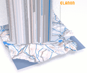 Places with similar names to El Anón, Dominican Republic ::
Disclaimer :: Information on this page comes without warranty of any kind |
||
|
Where is El Anón? Elevation and coordinates ::
Latitude (lat): 18°23'0"N Longitude (lon): 71°12'0"W
Elevation (approx.): 25m (map arrows pan, magnifying glasses zoom) |
||
|
Visiting El Anón? Hotel/Accommodation ::
Book a hotel in El Anón Travel Guide ::
rental cars ::
car rental offers GPS waypoint ::
download a GPX waypoint (PoI) of El Anón for your GPS receiver
|
||