|
search place name
|
||
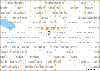
El Hatico (La Vega, Dominican Republic)El Hatico is a town in the La Vega region of Dominican Republic. An overview map of the region around El Hatico is displayed below.
regional and 3d topo map of El Hatico, Dominican Republic ::
El Hatico airports ::
The nearest airport is STI - Santiago Cibao Intl, located 20.0 km north of El Hatico.
Other airports nearby include POP - Puerto Plata Gregorio Luperon Intl (58.1 km north), BRX - Barahona Maria Montez Intl (124.2 km south west), SDQ - Santo Domingo Las Americas Intl (128.6 km south east), CAP - Cap Haitien Intl (181.3 km west), Nearby towns ::
La Cabra (1.9km south) //
La Laguna (1.9km north) //
Los Martínez (1.9km north) //
Monte Grande (1.7km west) //
Villa Turey (2.5km south east) //
Villa Hollywood (2.5km south east) //
El Guabal (2.5km south east) //
La Cigua (2.5km south east) //
La Joya (2.5km north west) //
Los Callejones (2.5km north west) //
Los Rincones (2.5km north west) //
Arenoso (2.5km north east) //
El Higüero (3.5km east) //
El Guabay (3.7km south) //
Las Tres Cruces (3.7km south) //
Yamí (3.5km west) //
Bayacanes (3.5km west) //
Loma del Santo Cerro (3.7km north) //
Pontón Abajo (4.0km south east) //
Concepción de La Vega (4.0km south east) //
Palmarito (4.0km south east) //
El Río Arriba (4.0km south west) //
Quebrada Honda la Cueva (4.0km north east) //
Soto y La Pocilga (4.0km north east) //
Los Mota (4.0km north west) //
La Guaranita (4.0km north west) //
Río Seco (4.1km north east) //
Pilarejo (4.1km north east) //
Guaco (4.1km north west) //
[all distances 'as the bird flies' and approximate] 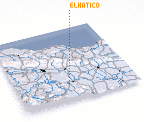 Places with similar names to El Hatico, Dominican Republic ::
Disclaimer :: Information on this page comes without warranty of any kind |
||
|
Where is El Hatico? Elevation and coordinates ::
Latitude (lat): 19°14'0"N Longitude (lon): 70°33'0"W
Elevation (approx.): 101m (map arrows pan, magnifying glasses zoom) |
||
|
Visiting El Hatico? Hotel/Accommodation ::
Book a hotel in El Hatico Travel Guide ::
rental cars ::
car rental offers GPS waypoint ::
download a GPX waypoint (PoI) of El Hatico for your GPS receiver
|
||