|
search place name
|
||
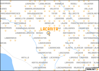
La Cañita (Peravia, Dominican Republic)La Cañita is a town in the Peravia region of Dominican Republic. An overview map of the region around La Cañita is displayed below.
regional and 3d topo map of La Cañita, Dominican Republic ::
La Cañita airports ::
The nearest airport is BRX - Barahona Maria Montez Intl, located 75.4 km west of La Cañita.
Other airports nearby include SDQ - Santo Domingo Las Americas Intl (82.7 km east), STI - Santiago Cibao Intl (103.4 km north), POP - Puerto Plata Gregorio Luperon Intl (141.7 km north), LRM - La Romana Casa De Campo Intl (162.5 km east), Nearby towns ::
El Pinar Grande (0.0km north) //
La Palma (1.9km south) //
Los Martínez (1.9km south) //
Monte Grande (2.6km north east) //
El Toro (2.6km north east) //
Los Naranjos (3.5km west) //
El Limón (3.5km west) //
Méndez (3.5km west) //
Los Naranjales (3.7km south) //
Manaclar (3.7km north) //
Los Ranchitos (4.0km south west) //
El Jengibre (4.0km north west) //
Los Rincones (4.1km south west) //
Las Caobas (4.1km south west) //
El Camarón (4.0km north east) //
Los Arroyos (4.1km north east) //
Los Limoncillos (4.1km north east) //
Los Anones (4.1km north east) //
El Manielito (5.1km north east) //
La Manacla (5.6km north) //
Hoyo Nuevo (5.3km east) //
La Cabilma (5.3km east) //
Juan Grande (5.6km east) //
Angelito (5.6km west) //
El Sillón (5.8km north) //
La Pringamosa (5.8km north) //
Los Ranchos (5.8km south) //
Parra (6.6km north west) //
El Tamarindo (6.6km north west) //
[all distances 'as the bird flies' and approximate] 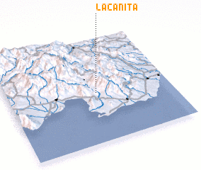 Places with similar names to La Cañita, Dominican Republic ::
Disclaimer :: Information on this page comes without warranty of any kind |
||
|
Where is La Cañita? Elevation and coordinates ::
Latitude (lat): 18°29'0"N Longitude (lon): 70°27'0"W
Elevation (approx.): 1000m (map arrows pan, magnifying glasses zoom) |
||
|
Visiting La Cañita? Hotel/Accommodation ::
Book a hotel in La Cañita Travel Guide ::
rental cars ::
car rental offers GPS waypoint ::
download a GPX waypoint (PoI) of La Cañita for your GPS receiver
|
||