|
search place name
|
||
La Cotorra (La Vega, Dominican Republic)La Cotorra is a town in the La Vega region of Dominican Republic. An overview map of the region around La Cotorra is displayed below.
regional and 3d topo map of La Cotorra, Dominican Republic ::

La Cotorra airports ::
The nearest airport is STI - Santiago Cibao Intl, located 49.1 km north of La Cotorra.
Other airports nearby include POP - Puerto Plata Gregorio Luperon Intl (88.2 km north), BRX - Barahona Maria Montez Intl (92.5 km south west), SDQ - Santo Domingo Las Americas Intl (120.9 km south east), PAP - Port-au-prince Toussaint Louverture Intl (176.7 km west), Nearby towns ::
El Pomito (1.8km east) //
La Vaca Blanca (1.9km south) //
Chicharrón (2.6km south west) //
El Haití (2.6km south west) //
Los Sánchez (2.6km south east) //
Suriel (3.5km west) //
La Cumbre (3.5km east) //
Tireo Abajo (3.7km south) //
Los Conuquitos Blancos (4.1km north west) //
El Café (4.0km south west) //
El Río (4.0km north east) //
Tireo Arriba (4.1km south west) //
La Cerca (4.1km south west) //
Tireo al Medio (4.1km south west) //
El Desecho (5.1km north east) //
La Pocilga (5.1km north east) //
El Alto de los Pinos (5.3km east) //
Arroyo El Rancho (5.6km north) //
El Alto de la Cumbre (5.6km north) //
Palerito (5.6km south) //
Belín (5.8km north) //
Cruz de Cuaba (5.6km west) //
La Novilla (5.8km south) //
La Pelá (5.6km east) //
La Canelilla (5.6km west) //
El Escuchadero (5.6km west) //
La Ceja del Muerto (6.4km north east) //
Josafá (6.4km north west) //
Arroyo La Vaca (6.6km north east) //
[all distances 'as the bird flies' and approximate] 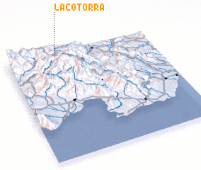 Places with similar names to La Cotorra, Dominican Republic ::
// Luki Tara (PH)
// La Cutarra (PA)
// La Cotorra (CU)
// La Guitarra (CU)
// La Cotera (ES)
// La Cuadra (ES)
// La Cuadra (ES)
// La Gotera (US)
// Lake Taro (US)
// Lekatero (CD)
Disclaimer :: Information on this page comes without warranty of any kind |
||
|
Where is La Cotorra? Elevation and coordinates ::
Latitude (lat): 18°58'0"N Longitude (lon): 70°40'0"W
Elevation (approx.): 1272m (map arrows pan, magnifying glasses zoom) |
||
|
Visiting La Cotorra? Hotel/Accommodation ::
Book a hotel in La Cotorra Travel Guide ::
rental cars ::
car rental offers GPS waypoint ::
download a GPX waypoint (PoI) of La Cotorra for your GPS receiver
|
||