|
search place name
|
||
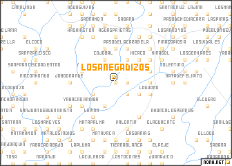
Los Anegadizos (Monte Plata, Dominican Republic)Los Anegadizos is a town in the Monte Plata region of Dominican Republic. An overview map of the region around Los Anegadizos is displayed below.
regional and 3d topo map of Los Anegadizos, Dominican Republic ::
Los Anegadizos airports ::
The nearest airport is SDQ - Santo Domingo Las Americas Intl, located 28.1 km south of Los Anegadizos.
Other airports nearby include LRM - La Romana Casa De Campo Intl (85.4 km east), STI - Santiago Cibao Intl (125.7 km north west), PUJ - Punta Cana Intl (139.9 km east), POP - Puerto Plata Gregorio Luperon Intl (151.1 km north west), Nearby towns ::
Paso Los Anegadizos (0.0km north) //
Carabela Abajo (0.0km north) //
Palmilla (1.8km east) //
Carabela (2.6km south east) //
El Pomito (4.0km south east) //
Carabela Abajo (4.1km south west) //
Mata de la Buena Vista (4.1km north east) //
Batey Carabela (4.0km south west) //
Mata de la Carabela (4.1km north east) //
Cojobal (4.1km north west) //
Hicaco (5.1km north east) //
Cueva de Valerio (5.3km east) //
Cruz de Valerio (5.3km east) //
El Caño (5.6km north) //
La Guama (5.6km east) //
Paso de la Carabela (5.8km north) //
Cojobal Abajo (5.6km west) //
Yaví (5.6km west) //
Ladino (5.6km east) //
La Mata del Toro (5.8km north) //
Las Parras (6.6km south east) //
Yabacao Arriba (6.4km south west) //
Juana Lorenza (6.4km north east) //
Ladino (6.4km north east) //
La Piña (6.6km south west) //
Buenos Aires (6.6km south west) //
Aguas Prietas (7.4km north) //
Jobo Grande (7.0km west) //
Valentín (7.6km south) //
[all distances 'as the bird flies' and approximate]  Places with similar names to Los Anegadizos, Dominican Republic ::
Disclaimer :: Information on this page comes without warranty of any kind |
||
|
Where is Los Anegadizos? Elevation and coordinates ::
Latitude (lat): 18°41'0"N Longitude (lon): 69°41'0"W
Elevation (approx.): 28m (map arrows pan, magnifying glasses zoom) |
||
|
Visiting Los Anegadizos? Hotel/Accommodation ::
Book a hotel in Los Anegadizos Travel Guide ::
rental cars ::
car rental offers GPS waypoint ::
download a GPX waypoint (PoI) of Los Anegadizos for your GPS receiver
|
||