|
search place name
|
||
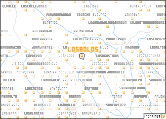
Los Bolos (El Seíbo, Dominican Republic)Los Bolos is a town in the El Seíbo region of Dominican Republic. An overview map of the region around Los Bolos is displayed below.
regional and 3d topo map of Los Bolos, Dominican Republic ::
Los Bolos airports ::
The nearest airport is LRM - La Romana Casa De Campo Intl, located 57.2 km south east of Los Bolos.
Other airports nearby include SDQ - Santo Domingo Las Americas Intl (66.7 km south west), PUJ - Punta Cana Intl (97.5 km east), STI - Santiago Cibao Intl (156.1 km north west), POP - Puerto Plata Gregorio Luperon Intl (171.7 km north west), Nearby towns ::
La Loreta (1.8km east) //
El Peñón (1.9km south) //
San Francisco (1.9km south) //
La Pocilga (2.6km north east) //
El Lial (2.6km south east) //
El Ranchito (2.6km south east) //
El Rancho (2.6km south east) //
Los Camarones (2.6km north west) //
Las Culebras (2.6km south west) //
La Loma (3.5km east) //
El Bejucal (3.5km east) //
Arroyón (3.5km east) //
La Boca de Bibiana (3.7km north) //
La Culebrita (3.7km north) //
Las Yayas (3.7km south) //
Rancho Chiquito (3.7km south) //
Bibiana (3.5km west) //
Los Macos (3.5km west) //
Vicentillo (4.0km north east) //
Los Ranchitos (4.1km north east) //
La Subida de la Cuchilla (4.0km north east) //
Limoncillo (4.1km north east) //
La Parada (4.0km south east) //
Rancho Número Uno (4.1km south east) //
Doña Ana (4.1km south west) //
Garantía (4.1km south west) //
Yabón (5.1km north east) //
Hoyo Frío (5.1km north east) //
Mancorneta (5.1km south east) //
[all distances 'as the bird flies' and approximate] 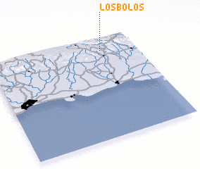 Places with similar names to Los Bolos, Dominican Republic ::
// Los Sábalos (PA)
// Las Bolas (CU)
// Los Sábalos (CU)
// Los Sábalos (CU)
// Los Bellos (CO)
// Las Blas (MX)
// Las Cebollas (MX)
// Las Cebollas (MX)
// Las Cebollas (MX)
// Las Cebollas (MX)
Disclaimer :: Information on this page comes without warranty of any kind |
||
|
Where is Los Bolos? Elevation and coordinates ::
Latitude (lat): 18°52'0"N Longitude (lon): 69°14'0"W
Elevation (approx.): 248m (map arrows pan, magnifying glasses zoom) |
||
|
Visiting Los Bolos? Hotel/Accommodation ::
Book a hotel in Los Bolos Travel Guide ::
rental cars ::
car rental offers GPS waypoint ::
download a GPX waypoint (PoI) of Los Bolos for your GPS receiver
|
||