|
search place name
|
||
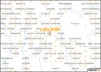
Los Lirios (Duarte, Dominican Republic)Los Lirios is a town in the Duarte region of Dominican Republic. An overview map of the region around Los Lirios is displayed below.
regional and 3d topo map of Los Lirios, Dominican Republic ::
Los Lirios airports ::
The nearest airport is STI - Santiago Cibao Intl, located 41.2 km west of Los Lirios.
Other airports nearby include POP - Puerto Plata Gregorio Luperon Intl (58.4 km north west), SDQ - Santo Domingo Las Americas Intl (117.1 km south east), BRX - Barahona Maria Montez Intl (154.5 km south west), LRM - La Romana Casa De Campo Intl (169.7 km south east), Nearby towns ::
Alto de Los Ortega (0.0km north) //
El Catey (0.0km north) //
Naranjo Dulce (0.0km north) //
Jaya (1.7km west) //
La Jagüita (1.9km north) //
Pantigoso (1.9km north) //
Las Yerbas (1.7km east) //
La Ceiba (2.5km north west) //
Los Cocos (2.5km south west) //
El Cercado (2.5km south east) //
Mata Vieja (3.5km west) //
Los Arroyos (3.5km west) //
El Pomito (3.7km north) //
Los Ganchos de Jaya (3.7km north) //
Corozo (3.7km south) //
Cuevas (3.5km east) //
La Lomaza (4.1km north west) //
La Sequía (4.1km south west) //
Las Guázumas (4.1km south west) //
Los Basilios (4.0km north west) //
El Moro (4.0km north west) //
Sonador (4.0km north west) //
Madeja (4.0km south west) //
Jaragua (4.0km south west) //
Los Pomos (4.1km north east) //
La Zarza (4.1km south east) //
El Aguacate (4.1km south east) //
El Mango (4.0km south east) //
Los Ganchos de Cuaba (5.1km north east) //
[all distances 'as the bird flies' and approximate] 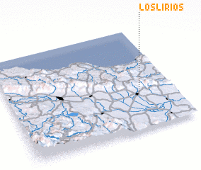 Places with similar names to Los Lirios, Dominican Republic ::
// Las Loras (PA)
// Los Lirios (PA)
// Los Alares (ES)
// Los Llares (ES)
// Los Loros (ES)
// Los Saleros (ES)
// Los Soleres (ES)
// Los Lirios (CL)
// Los Loros (CL)
// Las Lauras (CO)
Disclaimer :: Information on this page comes without warranty of any kind |
||
|
Where is Los Lirios? Elevation and coordinates ::
Latitude (lat): 19°21'0"N Longitude (lon): 70°13'0"W
Elevation (approx.): 237m (map arrows pan, magnifying glasses zoom) |
||
|
Visiting Los Lirios? Hotel/Accommodation ::
Book a hotel in Los Lirios Travel Guide ::
rental cars ::
car rental offers GPS waypoint ::
download a GPX waypoint (PoI) of Los Lirios for your GPS receiver
|
||