|
search place name
|
||
Managüita (Monte Plata, Dominican Republic)Managüita is a town in the Monte Plata region of Dominican Republic. An overview map of the region around Managüita is displayed below.
regional and 3d topo map of Managüita, Dominican Republic ::

Managüita airports ::
The nearest airport is SDQ - Santo Domingo Las Americas Intl, located 43.0 km south of Managüita.
Other airports nearby include LRM - La Romana Casa De Campo Intl (86.2 km south east), STI - Santiago Cibao Intl (121.3 km north west), PUJ - Punta Cana Intl (136.8 km east), POP - Puerto Plata Gregorio Luperon Intl (143.3 km north west), Nearby towns ::
Mata Santiago (1.9km south) //
Lajas (1.9km south) //
El Cercado (2.6km north west) //
Polonia (2.6km south east) //
Managua (2.6km south east) //
Los Sosa (2.6km south west) //
El Mogote (3.7km north) //
La Guaracha (3.5km east) //
La Altagracia (3.7km south) //
La Loma (4.1km north east) //
Los Berros (4.1km north east) //
Salto Grande (4.0km north east) //
La Cabuya (4.0km south east) //
Comatillo (4.0km south east) //
La Ceja (4.0km south west) //
Haití Quemado (5.1km north east) //
Sierra de Agua (5.1km north east) //
Los Peguero (5.1km north west) //
Santa Cruz (5.1km south east) //
Media Cara (5.1km south east) //
Dajao (5.3km west) //
La Mata del Jíbaro (5.3km east) //
La Altagracia (5.6km south) //
La Loma (5.6km north) //
El Carrizal (5.8km north) //
Juan Esteban (5.6km east) //
Esperanza (5.6km east) //
Los Córbanos (5.6km west) //
Sabana del Rodeo (5.8km north) //
[all distances 'as the bird flies' and approximate] 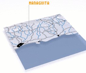 Places with similar names to Managüita, Dominican Republic ::
Disclaimer :: Information on this page comes without warranty of any kind |
||
|
Where is Managüita? Elevation and coordinates ::
Latitude (lat): 18°49'0"N Longitude (lon): 69°38'0"W
Elevation (approx.): 147m (map arrows pan, magnifying glasses zoom) |
||
|
Visiting Managüita? Hotel/Accommodation ::
Book a hotel in Managüita Travel Guide ::
rental cars ::
car rental offers GPS waypoint ::
download a GPX waypoint (PoI) of Managüita for your GPS receiver
|
||