|
search place name
|
||
Medina (San Cristóbal, Dominican Republic)Medina is a town in the San Cristóbal region of Dominican Republic. An overview map of the region around Medina is displayed below.
regional and 3d topo map of Medina, Dominican Republic ::

Medina airports ::
The nearest airport is SDQ - Santo Domingo Las Americas Intl, located 50.4 km east of Medina.
Other airports nearby include STI - Santiago Cibao Intl (108.6 km north west), BRX - Barahona Maria Montez Intl (108.9 km west), LRM - La Romana Casa De Campo Intl (129.3 km east), POP - Puerto Plata Gregorio Luperon Intl (143.1 km north), Nearby towns ::
Los Algarrobos (0.0km north) //
Media Cara (1.9km south) //
Los Corozos (1.8km east) //
Ochoa (1.9km north) //
Cataño (1.9km north) //
La Juliana (1.8km west) //
Los Pomos (2.6km south east) //
La Tarea (2.6km south west) //
El Fundo (2.6km south west) //
El Catalán (2.6km north east) //
Santa Cruz (2.6km north east) //
El Coco de Pedro Brand (2.6km north east) //
La Piedra (2.6km north west) //
Loma Sosúa (2.6km north west) //
Pedro Brand (3.5km east) //
Los Montones Abajo (3.5km east) //
Los Manacles (3.5km west) //
El Guanabanito (3.5km west) //
San Miguel (3.7km north) //
La Rosa (3.7km north) //
Mata Iglesia (3.7km north) //
Los Hoyos (4.1km south east) //
Rincón Largo (4.1km south east) //
Los Montones (4.0km south east) //
Ingenge (4.0km south east) //
Ramón (4.1km south west) //
Los Calimetes (4.0km south west) //
La Montosa (4.1km north east) //
La Joya (4.0km north west) //
[all distances 'as the bird flies' and approximate] 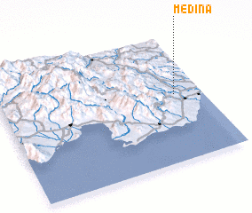 Places with similar names to Medina, Dominican Republic ::
Disclaimer :: Information on this page comes without warranty of any kind |
||
|
Where is Medina? Elevation and coordinates ::
Latitude (lat): 18°32'0"N Longitude (lon): 70°8'0"W
Elevation (approx.): 108m (map arrows pan, magnifying glasses zoom) |
||
|
Visiting Medina? Hotel/Accommodation ::
Book a hotel in Medina Travel Guide ::
rental cars ::
car rental offers GPS waypoint ::
download a GPX waypoint (PoI) of Medina for your GPS receiver
|
||