|
search place name
|
||
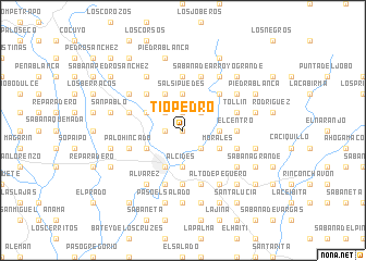
Tío Pedro (El Seíbo, Dominican Republic)Tío Pedro is a town in the El Seíbo region of Dominican Republic. An overview map of the region around Tío Pedro is displayed below.
regional and 3d topo map of Tío Pedro, Dominican Republic ::
Tío Pedro airports ::
The nearest airport is LRM - La Romana Casa De Campo Intl, located 40.2 km south of Tío Pedro.
Other airports nearby include PUJ - Punta Cana Intl (73.6 km east), SDQ - Santo Domingo Las Americas Intl (80.1 km south west), STI - Santiago Cibao Intl (180.1 km west), POP - Puerto Plata Gregorio Luperon Intl (194.7 km north west), Nearby towns ::
Santo Espíritu (0.0km north) //
El Llano (1.8km west) //
Capitán (1.9km north) //
Cañada del Cacao Arriba (1.9km north) //
Los Rincones (2.6km north west) //
Arroyo Grande (2.6km north east) //
Negro Viejo (2.6km north east) //
Santo Espíritu (2.6km south east) //
Salsipuedes (3.7km north) //
Los Bejucos (3.7km north) //
El Placer (3.7km south) //
Buenas Noches (3.7km south) //
Alcides (3.7km south) //
El Cabao (3.5km east) //
Los Botados (4.1km north west) //
Santa Cruz de El Seibo (4.1km south west) //
Buenos Aires (4.0km north west) //
Batey Kilómetro Dos (4.0km south west) //
Morales (4.0km south east) //
Caciquillo (5.1km north west) //
Guazumillas (5.1km north west) //
La Cerca (5.1km north west) //
Paso Dos Bocas (5.1km north east) //
Coamo Abajo (5.3km east) //
El Centro (5.3km east) //
Santa Teresa (5.6km south) //
Los Hoyos (5.6km north) //
Arroyo Grande (5.6km north) //
El Caimito (5.8km south) //
[all distances 'as the bird flies' and approximate]  Places with similar names to Tío Pedro, Dominican Republic ::
// Tío Pedro (CU)
// Chapdar (IR)
// Chap Darreh (IR)
// Chap Darreh (IR)
// Chap Darreh (IR)
// Chupadera (US)
// Chupadero (US)
// Chupadero (CO)
// Chupadero (CO)
// Chupadero (GT)
Disclaimer :: Information on this page comes without warranty of any kind |
||
|
Where is Tío Pedro? Elevation and coordinates ::
Latitude (lat): 18°48'0"N Longitude (lon): 69°1'0"W
Elevation (approx.): 125m (map arrows pan, magnifying glasses zoom) |
||
|
Visiting Tío Pedro? Hotel/Accommodation ::
Book a hotel in Tío Pedro Travel Guide ::
rental cars ::
car rental offers GPS waypoint ::
download a GPX waypoint (PoI) of Tío Pedro for your GPS receiver
|
||