|
search place name
|
||
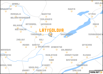
Latygolova (Belarus)Latygolova is a town in Belarus. An overview map of the region around Latygolova is displayed below.
regional and 3d topo map of Latygolova, Belarus ::
Latygolova airports ::
The nearest airport is VTB - Vitebsk, located 32.9 km south of Latygolova.
Nearby towns ::
Kabishche (1.9km north west) //
Kuli (2.8km south west) //
Denisovka (3.9km north) //
Gribenitsa (4.7km south) //
Shchuchino (4.7km south) //
Trashkova (3.2km west) //
Khobaty (3.2km east) //
Shukhvosty (3.2km east) //
Borovtsy (3.7km north west) //
Teplenʼkoye (5.7km north) //
Shnitsy (4.9km south west) //
Nikolayevo (7.4km south) //
Budnitsa (7.5km north) //
Galabordy (6.4km south east) //
Antonopolʼ (5.6km north west) //
Krasnyy Dvor (8.5km south east) //
[all distances 'as the bird flies' and approximate] 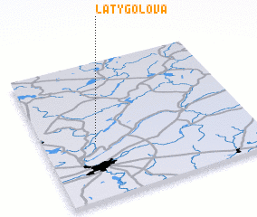 Places with similar names to Latygolova, Belarus ::
// Leta Kolfē (ET)
Disclaimer :: Information on this page comes without warranty of any kind |
||
|
Where is Latygolova? Elevation and coordinates ::
Latitude (lat): 55°25'0"N Longitude (lon): 30°15'0"E
Elevation (approx.): 152m (map arrows pan, magnifying glasses zoom) |
||
|
Visiting Latygolova? Hotel/Accommodation ::
Book a hotel in Latygolova Travel Guide ::
Buy a travel guide for Belarus rental cars ::
car rental offers GPS waypoint ::
download a GPX waypoint (PoI) of Latygolova for your GPS receiver
|
||