|
search place name
|
||
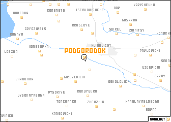
Podgorodok (Mahilyowskaya Voblastsʼ, Belarus)Podgorodok is a town in the Mahilyowskaya Voblastsʼ region of Belarus. An overview map of the region around Podgorodok is displayed below.
regional and 3d topo map of Podgorodok, Belarus ::
Podgorodok airports ::
The nearest airport is GME - Gomel, located 132.6 km south west of Podgorodok.
Other airports nearby include VTB - Vitebsk (199.4 km north west), Nearby towns ::
Timonovo (2.0km south) //
Klimavichy (3.2km north east) //
Gireyevichi (4.6km south) //
Khotenʼ (6.2km north) //
Doroginʼ (5.0km south west) //
Krugloye (6.9km north) //
Kukuyevka (7.6km south) //
Svirelʼ (7.2km north east) //
Osmolovichi (7.1km south east) //
Vysokiye (8.6km south west) //
Krasovicheskaya Sloboda (9.5km north) //
[all distances 'as the bird flies' and approximate] 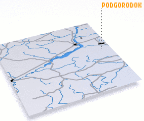 Places with similar names to Podgorodok, Belarus ::
// Podčardak (BA)
// Podgradac (BA)
// Podgradac (BA)
// Podgorodka (KZ)
// Pit-Gorodok (RU)
// Podgorodok (BY)
// Podogradak (HR)
Disclaimer :: Information on this page comes without warranty of any kind |
||
|
Where is Podgorodok? Elevation and coordinates ::
Latitude (lat): 53°35'15"N Longitude (lon): 31°55'12"E
Elevation (approx.): 153m (map arrows pan, magnifying glasses zoom) |
||
|
Visiting Podgorodok? Hotel/Accommodation ::
Book a hotel in Podgorodok Travel Guide ::
Buy a travel guide for Belarus rental cars ::
car rental offers GPS waypoint ::
download a GPX waypoint (PoI) of Podgorodok for your GPS receiver
|
||