|
search place name
|
||
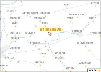
Strazhevo (Belarus)Strazhevo is a town in Belarus. An overview map of the region around Strazhevo is displayed below.
regional and 3d topo map of Strazhevo, Belarus ::
Strazhevo airports ::
The nearest airport is VTB - Vitebsk, located 64.4 km north of Strazhevo.
Nearby towns ::
Gatʼkovshchina (2.1km south west) //
Pirogi (3.9km north) //
Krasnyy Posëlok (3.9km south) //
Chizhovka (3.5km north east) //
Krapivnoye (5.3km south) //
Brili (5.5km south west) //
Andreyanovo (4.9km north west) //
Syaglovo (4.9km south west) //
Makarovka (6.1km north) //
Kudayevo (4.3km west) //
Golyashi (7.5km north) //
Zgarda (7.7km south) //
Gryazivka (7.7km south) //
Teolin (7.0km north east) //
Lyutkovshchina (8.6km north west) //
[all distances 'as the bird flies' and approximate] 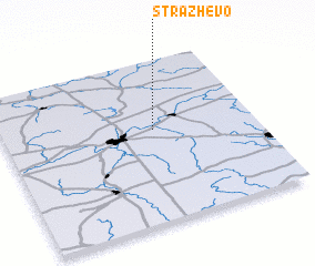 Places with similar names to Strazhevo, Belarus ::
// Storozhev (RU)
// Storozhevo (RU)
// Storozhevoy (RU)
// Storozhevoy (RU)
// Strezhevoy (RU)
// Strizhëvo (RU)
// Strizhovo (RU)
// Strizhovo (RU)
// Storozhov (UA)
// Strizhëv (UA)
Disclaimer :: Information on this page comes without warranty of any kind |
||
|
Where is Strazhevo? Elevation and coordinates ::
Latitude (lat): 54°34'0"N Longitude (lon): 30°36'0"E
Elevation (approx.): 180m (map arrows pan, magnifying glasses zoom) |
||
|
Visiting Strazhevo? Hotel/Accommodation ::
Book a hotel in Strazhevo Travel Guide ::
Buy a travel guide for Belarus rental cars ::
car rental offers GPS waypoint ::
download a GPX waypoint (PoI) of Strazhevo for your GPS receiver
|
||