|
search place name
|
||
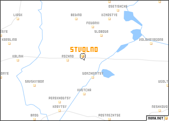
Stvolʼno (Belarus)Stvolʼno is a town in Belarus. An overview map of the region around Stvolʼno is displayed below.
regional and 3d topo map of Stvolʼno, Belarus ::
Stvolʼno airports ::
The nearest airport is MSQ - Minsk 2, located 100.2 km south of Stvolʼno.
Other airports nearby include MHP - Minsk 1 (112.4 km south west), Nearby towns ::
Zaboyenʼye (1.9km north) //
Rozhno (2.1km west) //
Domzheritsy (3.9km south) //
Sloboda (6.0km north) //
Kvetcha (7.4km south) //
Fëdorki (7.5km north) //
[all distances 'as the bird flies' and approximate]  Places with similar names to Stvolʼno, Belarus ::
// Stvol'no (RU)
// Stevelin (DE)
// Setuphulane (ZA)
// Sowdāghlān (IR)
// Sū Dāghelān (IR)
// Steffeln (DE)
// Stvolny (CZ)
// Sidvallen (SE)
Disclaimer :: Information on this page comes without warranty of any kind |
||
|
Where is Stvolʼno? Elevation and coordinates ::
Latitude (lat): 54°46'0"N Longitude (lon): 28°19'0"E
Elevation (approx.): 177m (map arrows pan, magnifying glasses zoom) |
||
|
Visiting Stvolʼno? Hotel/Accommodation ::
Book a hotel in Stvolʼno Travel Guide ::
Buy a travel guide for Belarus rental cars ::
car rental offers GPS waypoint ::
download a GPX waypoint (PoI) of Stvolʼno for your GPS receiver
|
||