|
search place name
|
||
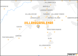
Villa Hogar Alemán (Buenos Aires, Argentina)Villa Hogar Alemán is a town in the Buenos Aires region of Argentina. An overview map of the region around Villa Hogar Alemán is displayed below.
regional and 3d topo map of Villa Hogar Alemán, Argentina ::
Villa Hogar Alemán airports ::
The nearest airport is AEP - Buenos Aires Aeroparque Jorge Newbery, located 30.5 km north of Villa Hogar Alemán.
Other airports nearby include LPG - La Plata (51.6 km east), GHU - Gualeguaychu (202.9 km north), Nearby towns ::
Burzaco (3.6km north east) //
Luis Guillón (4.0km north) //
Florencio Varela (3.5km east) //
Longchamps (3.9km south east) //
Barrio Esteban Echeverría (4.4km north west) //
Esteban Echeverría (4.7km north west) //
Santa Catalina (5.6km north) //
Llavallol (5.6km north) //
Almirante Brown (5.7km north east) //
Turdera (6.3km north east) //
Temperley (6.3km north east) //
Villa El Rincón (6.3km north west) //
Ministro Rivadavia (6.4km east) //
José Mármol (7.2km north east) //
Villa Galicia (7.2km north east) //
Glew (7.6km south east) //
Rafael Calzada (7.1km north east) //
Lomas de Zamora (8.0km north) //
[all distances 'as the bird flies' and approximate] 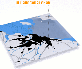 Places with similar names to Villa Hogar Alemán, Argentina :: Disclaimer :: Information on this page comes without warranty of any kind |
||
|
Where is Villa Hogar Alemán? Elevation and coordinates ::
Latitude (lat): 34°50'0"S Longitude (lon): 58°26'0"W
Elevation (approx.): 25m (map arrows pan, magnifying glasses zoom) |
||
|
Visiting Villa Hogar Alemán? Hotel/Accommodation ::
Book a hotel in Villa Hogar Alemán Travel Guide ::
Buy a travel guide for Argentina rental cars ::
car rental offers GPS waypoint ::
download a GPX waypoint (PoI) of Villa Hogar Alemán for your GPS receiver
|
||