|
search place name
|
||
Baw (Mandalay, Myanmar)Baw is a town in the Mandalay region of Myanmar. An overview map of the region around Baw is displayed below.
regional and 3d topo map of Baw, Myanmar ::

Baw airports ::
The nearest airport is HEH - Heho, located 85.9 km north east of Baw.
Other airports nearby include MDL - Mandalay Intl (174.5 km north), SNW - Thandwe (278.7 km south west), Nearby towns ::
Dayaukku (1.9km north) //
Nyaungbintha (2.5km south east) //
Magyigon (3.7km south) //
Dahattaw (3.7km north) //
Byaing-in (3.5km west) //
Natkin (3.9km north east) //
Tamagon (3.9km north east) //
Naungkhan (4.1km south west) //
Bawhlaing (4.1km south west) //
Ywathit (3.9km south west) //
Aungtha (5.1km north west) //
Kangyi (5.5km east) //
Sinthe (6.4km south west) //
Tatkon (6.4km south west) //
Nyaunggaing (6.6km north west) //
Pinthaung (6.6km north west) //
Kyatpye (7.0km east) //
Kintha (7.4km south) //
Kyauksayitkon (7.4km north) //
Kundaw (7.6km north east) //
Thagyahin-o (8.2km north east) //
Natma Myauk (8.9km north east) //
Ywezu (9.1km south west) //
Kyetthungin (9.1km north west) //
[all distances 'as the bird flies' and approximate] 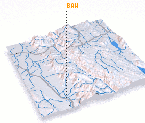 Places with similar names to Baw, Myanmar ::
Disclaimer :: Information on this page comes without warranty of any kind |
||
|
Where is Baw? Elevation and coordinates ::
Latitude (lat): 20°9'0"N Longitude (lon): 96°16'0"E
Elevation (approx.): 156m (map arrows pan, magnifying glasses zoom) |
||
|
Visiting Baw? Hotel/Accommodation ::
Book a hotel in Baw Travel Guide ::
Buy a travel guide for Myanmar rental cars ::
car rental offers GPS waypoint ::
download a GPX waypoint (PoI) of Baw for your GPS receiver
|
||