|
search place name
|
||
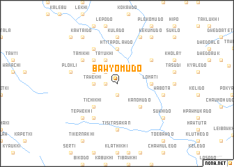
Bawyomudo (Kayin, Myanmar)Bawyomudo is a town in the Kayin region of Myanmar. An overview map of the region around Bawyomudo is displayed below.
regional and 3d topo map of Bawyomudo, Myanmar ::
Bawyomudo airports ::
The nearest airport is RGN - Yangon Intl, located 207.9 km south west of Bawyomudo.
Nearby towns ::
Chomode (1.8km west) //
Klekawkhi (1.9km south) //
Todekhiso (2.6km north west) //
Tawekhi (3.5km west) //
Tayukhi (4.1km north west) //
Tokumudo (4.0km north west) //
Sisukhi (5.1km north west) //
Plaplekhi (5.1km south west) //
Tichikhi (5.1km south west) //
Kanomudo (5.1km south east) //
Lomati (5.3km east) //
Khosado (5.3km east) //
Besawlaw (5.6km north) //
Htitapolawdo (5.6km north) //
Bethawlaw (5.6km north) //
Tanyalawdo (6.4km north east) //
Talata (6.6km north west) //
Nawkade (6.6km south west) //
Tamikhi (6.4km north west) //
Kulado (7.4km north) //
Tisita Sakan (7.4km south) //
Plokli (7.3km west) //
Wabota (7.3km east) //
Tekokhi (7.7km south west) //
Tepwekhi (7.7km south west) //
Htasude (8.2km north east) //
Kekumudo (9.1km north east) //
Sukhido (9.0km south east) //
Kawtaido (9.1km north west) //
[all distances 'as the bird flies' and approximate] 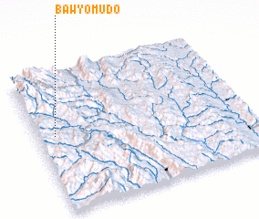 Places with similar names to Bawyomudo, Myanmar ::
Disclaimer :: Information on this page comes without warranty of any kind |
||
|
Where is Bawyomudo? Elevation and coordinates ::
Latitude (lat): 18°33'0"N Longitude (lon): 97°5'0"E
Elevation (approx.): 958m (map arrows pan, magnifying glasses zoom) |
||
|
Visiting Bawyomudo? Hotel/Accommodation ::
Book a hotel in Bawyomudo Travel Guide ::
Buy a travel guide for Myanmar rental cars ::
car rental offers GPS waypoint ::
download a GPX waypoint (PoI) of Bawyomudo for your GPS receiver
|
||