|
search place name
|
||
Buyauk (Sagaing, Myanmar)Buyauk is a town in the Sagaing region of Myanmar. An overview map of the region around Buyauk is displayed below.
regional and 3d topo map of Buyauk, Myanmar ::

Buyauk airports ::
The nearest airport is MDL - Mandalay Intl, located 11.7 km north of Buyauk.
Other airports nearby include HEH - Heho (128.7 km south east), LSH - Lashio (240.4 km north east), Nearby towns ::
Myinzaing (1.7km east) //
Mogyodwin (3.9km north east) //
Thetpan (4.1km south west) //
Aungtha North (5.1km south east) //
Aungtha (5.1km south east) //
Kyaukphu (5.1km north west) //
Onhmin (5.8km north) //
Einkan (5.8km north) //
Thamankan (5.8km north) //
Theinnigan (5.5km west) //
Tanaungbinhla (6.5km south east) //
Aungtha South (6.5km south east) //
Thindein (6.5km south west) //
Chaunggwe (7.4km north) //
Nwachangyigon (6.9km west) //
Kyi-eik (7.1km east) //
Khabo (7.1km west) //
Tanlondat (7.1km east) //
Kyibin (7.6km south) //
Dwehla (7.8km north east) //
Sibingwe (7.8km south west) //
Nwadatkon (7.8km south east) //
Pyawywa (8.2km south east) //
Eswa (8.2km south west) //
Gwezaung (9.0km south west) //
Shabin (10.1km north east) //
[all distances 'as the bird flies' and approximate] 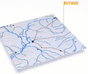 Places with similar names to Buyauk, Myanmar ::
Disclaimer :: Information on this page comes without warranty of any kind |
||
|
Where is Buyauk? Elevation and coordinates ::
Latitude (lat): 21°36'0"N Longitude (lon): 95°57'0"E
Elevation (approx.): 107m (map arrows pan, magnifying glasses zoom) |
||
|
Visiting Buyauk? Hotel/Accommodation ::
Book a hotel in Buyauk Travel Guide ::
Buy a travel guide for Myanmar rental cars ::
car rental offers GPS waypoint ::
download a GPX waypoint (PoI) of Buyauk for your GPS receiver
|
||