|
search place name
|
||
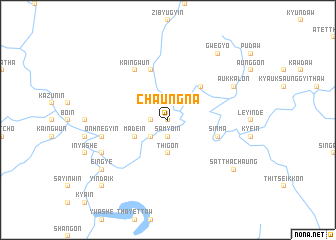
Chaungna (Sagaing, Myanmar)Chaungna is a town in the Sagaing region of Myanmar. An overview map of the region around Chaungna is displayed below.
regional and 3d topo map of Chaungna, Myanmar ::
Chaungna airports ::
The nearest airport is IMF - Imphal, located 198.7 km north west of Chaungna.
Other airports nearby include MDL - Mandalay Intl (222.8 km south), MYT - Myitkyina (273.3 km north east), Nearby towns ::
Ngapyawdaw (0.0km north) //
Monan (0.0km north) //
Tagaung-aing (1.7km west) //
Samyo-in (1.9km south) //
Thayetkyin (2.5km south west) //
Okkan (2.5km north east) //
Taunggya (3.7km south) //
Thigon (3.7km south) //
Madein (3.9km south west) //
Nyaungbinhla (5.0km north east) //
Ainggyi (5.8km north) //
Sinma (5.4km east) //
Kaingwun (6.5km north west) //
Onhnegyin (7.0km west) //
Okshitpin (7.7km south west) //
Shwedwin (7.7km north east) //
Aukkalon (7.7km north east) //
Eingye (8.8km south west) //
Satthachaung (8.8km south east) //
Gwegyo (9.0km north east) //
Yindaik (10.1km south west) //
[all distances 'as the bird flies' and approximate] 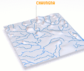 Places with similar names to Chaungna, Myanmar ::
Disclaimer :: Information on this page comes without warranty of any kind |
||
|
Where is Chaungna? Elevation and coordinates ::
Latitude (lat): 23°39'0"N Longitude (lon): 95°26'0"E
Elevation (approx.): 171m (map arrows pan, magnifying glasses zoom) |
||
|
Visiting Chaungna? Hotel/Accommodation ::
Book a hotel in Chaungna Travel Guide ::
Buy a travel guide for Myanmar rental cars ::
car rental offers GPS waypoint ::
download a GPX waypoint (PoI) of Chaungna for your GPS receiver
|
||