|
search place name
|
||
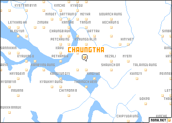
Chaungtha (Rakhine, Myanmar)Chaungtha is a town in the Rakhine region of Myanmar. An overview map of the region around Chaungtha is displayed below.
regional and 3d topo map of Chaungtha, Myanmar ::
Chaungtha airports ::
The nearest airport is KYP - Kyaukpyu, located 45.8 km west of Chaungtha.
Other airports nearby include SNW - Thandwe (118.5 km south), AKY - Sittwe (135.3 km north west), Nearby towns ::
Kyauktaung (1.9km south) //
Myaukkaik (2.5km south west) //
Awabyin (2.5km north west) //
Kyaungdalin (3.7km north) //
Mindet (3.7km north) //
Kingyun (4.1km south east) //
Hteindaw (5.1km north west) //
Mezali (5.2km east) //
Thaingchwein (5.6km south) //
Pethamaw (5.2km west) //
Dattaw (5.8km north) //
Shaukchon (5.6km east) //
Taungpila (5.8km north) //
Kapu (5.6km west) //
Kangyungyi (6.4km south west) //
Wabyin (6.6km north west) //
Ngalaungbyin (6.4km north west) //
Petchaung (6.4km north west) //
Tandin (7.4km north) //
Nwayôndaung (7.6km north east) //
Chaungbauk (7.6km north west) //
Thaluchwein (7.6km south west) //
Padagyaw (7.9km north east) //
Chitponma (8.2km south west) //
Kanswe (8.2km north west) //
Wechaung (9.1km north east) //
Kyaukmyaung (8.9km south west) //
[all distances 'as the bird flies' and approximate] 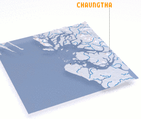 Places with similar names to Chaungtha, Myanmar ::
// Chani Goth (PK)
// Chung Thứ (VN)
// Chung Thuy (VN)
// Chaungtha (MM)
// Chaungtha (MM)
// Chaungtha (MM)
// Chaungtha (MM)
// Chaungtha (MM)
// Chaungtha (MM)
Disclaimer :: Information on this page comes without warranty of any kind |
||
|
Where is Chaungtha? Elevation and coordinates ::
Latitude (lat): 19°29'0"N Longitude (lon): 93°58'0"E
Elevation (approx.): -1m (map arrows pan, magnifying glasses zoom) |
||
|
Visiting Chaungtha? Hotel/Accommodation ::
Book a hotel in Chaungtha Travel Guide ::
Buy a travel guide for Myanmar rental cars ::
car rental offers GPS waypoint ::
download a GPX waypoint (PoI) of Chaungtha for your GPS receiver
|
||