|
search place name
|
||
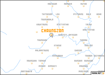
Chaungzon (Sagaing, Myanmar)Chaungzon is a town in the Sagaing region of Myanmar. An overview map of the region around Chaungzon is displayed below.
regional and 3d topo map of Chaungzon, Myanmar ::
Chaungzon airports ::
The nearest airport is IMF - Imphal, located 151.3 km north west of Chaungzon.
Nearby towns ::
Seintgyi (3.4km east) //
Kywede (4.1km south east) //
Taungdaw (3.9km south west) //
Atet Yintha (5.0km north east) //
Kauktaung (5.0km north west) //
Thayetkon (5.4km west) //
Taungbohla (5.8km north) //
Palapataung (6.5km south west) //
Omyegon (6.8km east) //
Le-u (7.6km north) //
Thitsegon (7.6km north) //
Hinnubauk (7.6km south) //
[all distances 'as the bird flies' and approximate]  Places with similar names to Chaungzon, Myanmar ::
// Chiang Saen (TH)
// Chingasan (RU)
// Ch'angsan (KP)
// Changsan (KP)
// Changsan (KP)
// Changsan (KP)
// Chŏngsan (KP)
// Chŭngsan (KP)
// Chungsan (KP)
// Chungsan-ni (KP)
Disclaimer :: Information on this page comes without warranty of any kind |
||
|
Where is Chaungzon? Elevation and coordinates ::
Latitude (lat): 24°13'0"N Longitude (lon): 95°16'0"E
Elevation (approx.): 326m (map arrows pan, magnifying glasses zoom) |
||
|
Visiting Chaungzon? Hotel/Accommodation ::
Book a hotel in Chaungzon Travel Guide ::
Buy a travel guide for Myanmar rental cars ::
car rental offers GPS waypoint ::
download a GPX waypoint (PoI) of Chaungzon for your GPS receiver
|
||