|
search place name
|
||
Dawhsè (Kayah, Myanmar)Dawhsè is a town in the Kayah region of Myanmar. An overview map of the region around Dawhsè is displayed below.
regional and 3d topo map of Dawhsè, Myanmar ::

Dawhsè airports ::
The nearest airport is HEH - Heho, located 132.9 km north west of Dawhsè.
Other airports nearby include MOG - Mong Hsat (202.4 km north east), MDL - Mandalay Intl (268.0 km north west), Nearby towns ::
Daw Ta-ri-ta (1.9km north) //
Dawhso-klè (3.5km west) //
Daw No-hku (3.7km south) //
Daw Kawlè (3.7km south) //
Daw Su-la (5.1km north east) //
Dawmu-ma (5.6km south) //
Daw Wè-lè (5.6km south) //
Daw Su-la (5.6km east) //
Daw Pu-hsaw (5.6km east) //
Hsu-hpè-law (6.4km north west) //
Daw Hsawglè (6.4km north east) //
Daw Hsè (7.4km south) //
Dawlè-lu (7.4km south) //
Daw Ta-nawno (7.4km north) //
Daw Htè-ku (7.2km east) //
Wān Hwè-ngao-nawn (7.6km south east) //
Na-keng-awn (7.6km south east) //
Daw Htè-ku (8.2km south east) //
Tinloi-pu-la-wa (7.9km south east) //
Kang Ti (8.9km south west) //
[all distances 'as the bird flies' and approximate] 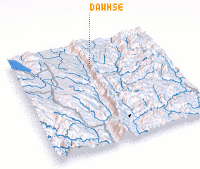 Places with similar names to Dawhsè, Myanmar ::
Disclaimer :: Information on this page comes without warranty of any kind |
||
|
Where is Dawhsè? Elevation and coordinates ::
Latitude (lat): 19°45'0"N Longitude (lon): 97°30'0"E
Elevation (approx.): 1033m (map arrows pan, magnifying glasses zoom) |
||
|
Visiting Dawhsè? Hotel/Accommodation ::
Book a hotel in Dawhsè Travel Guide ::
Buy a travel guide for Myanmar rental cars ::
car rental offers GPS waypoint ::
download a GPX waypoint (PoI) of Dawhsè for your GPS receiver
|
||