|
search place name
|
||
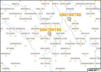
Daw Ta-htaw (Kayah, Myanmar)Daw Ta-htaw is a town in the Kayah region of Myanmar. An overview map of the region around Daw Ta-htaw is displayed below.
regional and 3d topo map of Daw Ta-htaw, Myanmar ::
Daw Ta-htaw airports ::
The nearest airport is HEH - Heho, located 137.2 km north of Daw Ta-htaw.
Nearby towns ::
Naungpale (0.0km north) //
Daw Glo-hku (1.7km west) //
Daw No-hku (2.5km north west) //
Daw Ta-ngu (2.5km north west) //
Daw Taw-lè (2.5km south west) //
Wān Sa-rè-aw (2.5km north east) //
Ta-lā-lè (2.5km south east) //
Ya-hsa-lya (3.7km north) //
Pya-mü-daw (3.7km north) //
Daw Hsè-i (3.5km west) //
Daw Ta-ma (3.5km east) //
Lawdawhku (4.1km north west) //
Kyauk-sè (4.1km north east) //
Ngwedaung (4.1km south east) //
Daw Di-po (4.0km north west) //
Daw Hpa-lè-taw (4.0km south east) //
Ta-mö-lè (5.2km west) //
Hsè-hsu-lè (5.8km north) //
So-dè-hku (5.8km south) //
Daw Lo-hku (5.8km south) //
Ngwedaung (5.6km east) //
Me-hawng (5.6km west) //
Wān Loi-nanghpa (6.4km north west) //
Daw Ta-sa (7.4km north) //
Daw Ta-wè (7.2km west) //
Daw Glo-hku (7.2km east) //
Ka-da-la (7.6km south) //
Hsi-sawhku (7.6km south) //
Daw Glo-hku (7.6km north east) //
[all distances 'as the bird flies' and approximate] 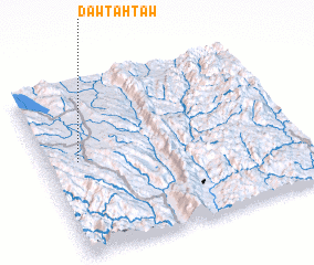 Places with similar names to Daw Ta-htaw, Myanmar ::
Disclaimer :: Information on this page comes without warranty of any kind |
||
|
Where is Daw Ta-htaw? Elevation and coordinates ::
Latitude (lat): 19°33'0"N Longitude (lon): 97°8'0"E
Elevation (approx.): 898m (map arrows pan, magnifying glasses zoom) |
||
|
Visiting Daw Ta-htaw? Hotel/Accommodation ::
Book a hotel in Daw Ta-htaw Travel Guide ::
Buy a travel guide for Myanmar rental cars ::
car rental offers GPS waypoint ::
download a GPX waypoint (PoI) of Daw Ta-htaw for your GPS receiver
|
||