|
search place name
|
||
Ganmindaw (Myanmar)Ganmindaw is a town in Myanmar. An overview map of the region around Ganmindaw is displayed below.
regional and 3d topo map of Ganmindaw, Myanmar ::

Ganmindaw airports ::
The nearest airport is RGN - Yangon Intl, located 187.9 km south of Ganmindaw.
Nearby towns ::
Obogon (0.0km north) //
Kinwaing (1.8km east) //
Nawkhin (1.9km north) //
Nyaunglwin (1.9km north) //
Pyaungthe (2.6km south west) //
Zayatkwin (2.6km south west) //
Okhne (2.6km south west) //
Pyaungthe Ashe (2.6km south west) //
Pyaungthe Anauk (2.6km south west) //
Shanzu (2.6km north west) //
Kyaungzu (3.7km south) //
Hmankwin (3.7km south) //
Okpo (3.7km north) //
Zeyawadi (4.1km south east) //
Jaipur (4.1km south east) //
Patta (4.0km south east) //
Domakhin (4.0km north east) //
Chinzu (4.1km north west) //
Kayin (4.1km north west) //
Payahnitsu Anauk (4.1km north west) //
Nyaunggaing (5.1km south east) //
Paukkon (5.1km north east) //
Payahnitsu Ale (5.6km north) //
Kyu-in Anauk (5.3km east) //
Kyu-in (5.3km east) //
Kyu-in Ashe (5.3km east) //
Khingyi (5.8km north) //
Seikpugon (5.8km north) //
Yeshan (5.8km north) //
[all distances 'as the bird flies' and approximate] 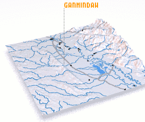 Places with similar names to Ganmindaw, Myanmar ::
// Kan Munot (PH)
// Kinmundy (US)
// Kinmount (CA)
// Quinnimont (US)
// Kanmantoo (AU)
// Kōnominato (JP)
// Gonminda (MM)
// Gonmindaw (MM)
// Kinmuntaw (MM)
// Guinaumont (BE)
Disclaimer :: Information on this page comes without warranty of any kind |
||
|
Where is Ganmindaw? Elevation and coordinates ::
Latitude (lat): 18°35'0"N Longitude (lon): 96°25'0"E
Elevation (approx.): 42m (map arrows pan, magnifying glasses zoom) |
||
|
Visiting Ganmindaw? Hotel/Accommodation ::
Book a hotel in Ganmindaw Travel Guide ::
Buy a travel guide for Myanmar rental cars ::
car rental offers GPS waypoint ::
download a GPX waypoint (PoI) of Ganmindaw for your GPS receiver
|
||