|
search place name
|
||
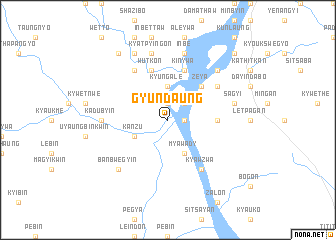
Gyundaung (Myanmar)Gyundaung is a town in Myanmar. An overview map of the region around Gyundaung is displayed below.
regional and 3d topo map of Gyundaung, Myanmar ::
Gyundaung airports ::
The nearest airport is SNW - Thandwe, located 104.4 km south west of Gyundaung.
Other airports nearby include KYP - Kyaukpyu (170.7 km west), HEH - Heho (260.9 km north east), Nearby towns ::
Okpo (1.9km north) //
Kama (1.9km north) //
Kamagale (1.8km east) //
Nangatkyun (2.6km north east) //
Kyungale (3.7km north) //
Kanzu (4.0km south west) //
Myawady (4.1km south east) //
Zeya (5.1km north east) //
Kalonmaw (5.3km east) //
Wutkon (5.8km north) //
Tanlebin (5.8km north) //
Toukshagon (5.8km north) //
Kinywa (5.8km north) //
Pazinnein (6.6km north west) //
Kyawzwa (6.6km south east) //
Zalon (6.4km north east) //
Gonminmyaung (7.0km west) //
Kadubyin (7.0km west) //
Putsu (7.0km west) //
Kyatpyingon (7.6km north) //
Inbè (7.6km north) //
Sagyi (7.2km east) //
Banbwegyin (7.7km south west) //
Nyaungbinzeik (7.7km north east) //
Okpon (8.2km north west) //
Minde (9.1km north west) //
Ngapyin (10.2km north east) //
Myinuashe (10.2km north east) //
[all distances 'as the bird flies' and approximate] 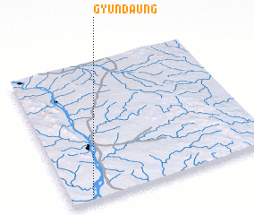 Places with similar names to Gyundaung, Myanmar ::
// Jiuyantang (CN)
Disclaimer :: Information on this page comes without warranty of any kind |
||
|
Where is Gyundaung? Elevation and coordinates ::
Latitude (lat): 19°1'0"N Longitude (lon): 95°6'0"E
Elevation (approx.): 31m (map arrows pan, magnifying glasses zoom) |
||
|
Visiting Gyundaung? Hotel/Accommodation ::
Book a hotel in Gyundaung Travel Guide ::
Buy a travel guide for Myanmar rental cars ::
car rental offers GPS waypoint ::
download a GPX waypoint (PoI) of Gyundaung for your GPS receiver
|
||