|
search place name
|
||
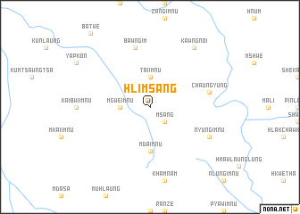
Hlimsang (Chin, Myanmar)Hlimsang is a town in the Chin region of Myanmar. An overview map of the region around Hlimsang is displayed below.
regional and 3d topo map of Hlimsang, Myanmar ::
Hlimsang airports ::
The nearest airport is AKY - Sittwe, located 142.3 km south west of Hlimsang.
Other airports nearby include CXB - Cox's Bazar Coxs Bazar (181.2 km west), KYP - Kyaukpyu (193.3 km south), CGP - Chittagong Shah Amanat Intl (227.6 km north west), Nearby towns ::
Msang (2.5km south east) //
Mgwe-imnu (3.5km west) //
Tai-imnu (3.7km north) //
Mda-imnu (5.6km south) //
Bawng-im (7.6km north) //
Chaung-yung (7.2km east) //
Nyung-imnu (7.8km south east) //
Kawngnoi (9.0km north east) //
[all distances 'as the bird flies' and approximate]  Places with similar names to Hlimsang, Myanmar ::
// Lime Sink (US)
// Limbosung (ID)
// Lombasang (ID)
// H.L.M. Çinq (SN)
// La Mouay Sang (LA)
// Lamassong (PG)
// Laem Sing (TH)
// Lamzang (MM)
// Lumzang (MM)
Disclaimer :: Information on this page comes without warranty of any kind |
||
|
Where is Hlimsang? Elevation and coordinates ::
Latitude (lat): 21°10'0"N Longitude (lon): 93°41'0"E
Elevation (approx.): 1254m (map arrows pan, magnifying glasses zoom) |
||
|
Visiting Hlimsang? Hotel/Accommodation ::
Book a hotel in Hlimsang Travel Guide ::
Buy a travel guide for Myanmar rental cars ::
car rental offers GPS waypoint ::
download a GPX waypoint (PoI) of Hlimsang for your GPS receiver
|
||