|
search place name
|
||
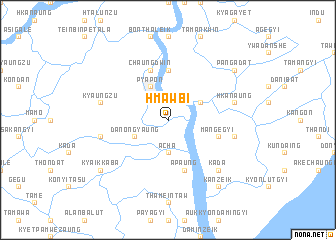
Hmawbi (Ayeyarwady, Myanmar)Hmawbi is a town in the Ayeyarwady region of Myanmar. An overview map of the region around Hmawbi is displayed below.
regional and 3d topo map of Hmawbi, Myanmar ::
Hmawbi airports ::
The nearest airport is RGN - Yangon Intl, located 86.2 km north east of Hmawbi.
Nearby towns ::
Acha (3.7km south) //
Myingagôn (4.0km north east) //
Pyapon (4.1km north west) //
Danongyaung (4.0km south west) //
Tamangyi (4.0km south west) //
Ônbin (5.6km north) //
Ma-ngegyi (5.7km east) //
Apaung (5.8km south) //
Chaungdwin (5.8km north) //
Kyônhpē (7.4km east) //
Hkanaung (7.4km east) //
Kyaungzu (7.4km west) //
Kyinabin (7.4km west) //
Kadā (7.7km south east) //
Kanzeik (9.1km south east) //
Kyaikkabā (9.0km south west) //
Pangadat (9.0km north east) //
[all distances 'as the bird flies' and approximate] 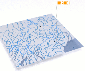 Places with similar names to Hmawbi, Myanmar ::
Disclaimer :: Information on this page comes without warranty of any kind |
||
|
Where is Hmawbi? Elevation and coordinates ::
Latitude (lat): 16°15'0"N Longitude (lon): 95°42'0"E
Elevation (approx.): 4m (map arrows pan, magnifying glasses zoom) |
||
|
Visiting Hmawbi? Hotel/Accommodation ::
Book a hotel in Hmawbi Travel Guide ::
Buy a travel guide for Myanmar rental cars ::
car rental offers GPS waypoint ::
download a GPX waypoint (PoI) of Hmawbi for your GPS receiver
|
||