|
search place name
|
||
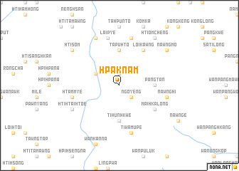
Hpaknam (Shan, Myanmar)Hpaknam is a town in the Shan region of Myanmar. An overview map of the region around Hpaknam is displayed below.
regional and 3d topo map of Hpaknam, Myanmar ::
Hpaknam airports ::
The nearest airport is HEH - Heho, located 93.0 km north west of Hpaknam.
Other airports nearby include MOG - Mong Hsat (188.1 km east), MDL - Mandalay Intl (227.1 km north west), Nearby towns ::
Nam-yan (1.9km north) //
Ngo-yeng (2.5km south east) //
Nampa-pong (3.9km north west) //
Tapuhto (5.6km north) //
Pangtan (5.2km east) //
Ti-hunhkwe (5.6km south) //
Mai-hka-long (6.4km south east) //
Loikawng (6.6km north east) //
Laipye (7.6km north) //
Hsaingon (7.6km north) //
Htammye (7.2km west) //
Nawnghi (7.2km east) //
Ti-wa-mü-pe (7.6km south) //
Htolawng (8.2km north west) //
Hti-htai-htoe (7.9km south west) //
Htiomcheng (9.1km north east) //
Htisöm (8.9km north west) //
Htamhsai (8.9km north west) //
Nawngmo (8.9km north east) //
Kawngmuput (8.9km north east) //
Wān Hka-lau (8.9km north east) //
[all distances 'as the bird flies' and approximate] 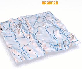 Places with similar names to Hpaknam, Myanmar ::
Disclaimer :: Information on this page comes without warranty of any kind |
||
|
Where is Hpaknam? Elevation and coordinates ::
Latitude (lat): 20°13'0"N Longitude (lon): 97°29'0"E
Elevation (approx.): 1356m (map arrows pan, magnifying glasses zoom) |
||
|
Visiting Hpaknam? Hotel/Accommodation ::
Book a hotel in Hpaknam Travel Guide ::
Buy a travel guide for Myanmar rental cars ::
car rental offers GPS waypoint ::
download a GPX waypoint (PoI) of Hpaknam for your GPS receiver
|
||