|
search place name
|
||
Hpya-ling (Shan, Myanmar)Hpya-ling is a town in the Shan region of Myanmar. An overview map of the region around Hpya-ling is displayed below.
regional and 3d topo map of Hpya-ling, Myanmar ::

Hpya-ling airports ::
The nearest airport is HEH - Heho, located 50.4 km south west of Hpya-ling.
Other airports nearby include MDL - Mandalay Intl (152.1 km north west), Nearby towns ::
Wān Maw (0.0km north) //
Loi-lin (0.0km north) //
Wān Pyi-yi (1.7km west) //
Htonbong (1.7km west) //
Konsa-lai (2.5km north east) //
Ti-lon (3.7km south) //
Tawng-san (3.9km north east) //
Konlang (5.1km north west) //
Hti-re (5.6km south) //
Mak Mong Non (5.8km north) //
Hwè-long (5.5km east) //
Nawng-yun (5.5km west) //
Wān Nā King (6.5km north west) //
Nammakmong (6.9km west) //
Ho Heng (7.6km north) //
Mak Hsang (7.2km west) //
Nyawngwing (7.6km south) //
Hsai-hkao (7.6km south west) //
Longwing (7.9km south east) //
Wān Ming Ak (8.2km north west) //
Mak Pak (8.2km north west) //
Wān Mak Lang (9.0km north west) //
Nyawng Kwai (9.0km north west) //
Loi-sang-mye (8.9km south west) //
Kawngpwa (9.1km south east) //
Leng-un (9.1km south west) //
[all distances 'as the bird flies' and approximate] 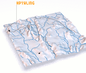 Places with similar names to Hpya-ling, Myanmar ::
// Pyalong (AU)
Disclaimer :: Information on this page comes without warranty of any kind |
||
|
Where is Hpya-ling? Elevation and coordinates ::
Latitude (lat): 20°58'0"N Longitude (lon): 97°13'0"E
Elevation (approx.): 1025m (map arrows pan, magnifying glasses zoom) |
||
|
Visiting Hpya-ling? Hotel/Accommodation ::
Book a hotel in Hpya-ling Travel Guide ::
Buy a travel guide for Myanmar rental cars ::
car rental offers GPS waypoint ::
download a GPX waypoint (PoI) of Hpya-ling for your GPS receiver
|
||