|
search place name
|
||
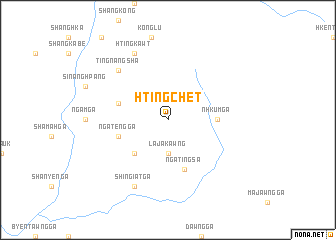
Htingchet (Kachin State, Myanmar)Htingchet is a town in the Kachin State region of Myanmar. An overview map of the region around Htingchet is displayed below.
regional and 3d topo map of Htingchet, Myanmar ::
Htingchet airports ::
The nearest airport is PBU - Putao, located 54.3 km west of Htingchet.
Other airports nearby include MYT - Myitkyina (208.1 km south), Nearby towns ::
Lajakawng (3.7km south) //
Ngalayang (5.0km south west) //
Nhkum Ga (4.9km east) //
Ngateng Ga (5.3km west) //
Hkanung Ladong (5.3km west) //
Nga Tingsa (5.8km south) //
Tingnangsha (7.4km north west) //
Shingiat Ga (8.1km south west) //
Htingkawt (8.1km north west) //
[all distances 'as the bird flies' and approximate] 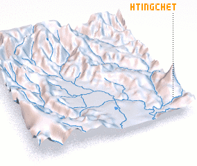 Places with similar names to Htingchet, Myanmar ::
// Tangsiat (MM)
// Ting-chiao-t'a (TW)
// Tung-shih-t'ou (TW)
// Ðong Tiot (VN)
// Tùng Chât (VN)
// Dongchatou (CN)
// Dongshuitou (CN)
Disclaimer :: Information on this page comes without warranty of any kind |
||
|
Where is Htingchet? Elevation and coordinates ::
Latitude (lat): 27°11'0"N Longitude (lon): 97°57'0"E
Elevation (approx.): 1422m (map arrows pan, magnifying glasses zoom) |
||
|
Visiting Htingchet? Hotel/Accommodation ::
Book a hotel in Htingchet Travel Guide ::
Buy a travel guide for Myanmar rental cars ::
car rental offers GPS waypoint ::
download a GPX waypoint (PoI) of Htingchet for your GPS receiver
|
||