|
search place name
|
||
Hunan (Shan, Myanmar)Hunan is a town in the Shan region of Myanmar. An overview map of the region around Hunan is displayed below.
regional and 3d topo map of Hunan, Myanmar ::

Hunan airports ::
The nearest airport is LSH - Lashio, located 84.1 km north east of Hunan.
Other airports nearby include MDL - Mandalay Intl (157.2 km south west), HEH - Heho (183.2 km south), MOG - Mong Hsat (280.7 km south east), Nearby towns ::
Nāsalawng (1.9km north) //
Nampwat (1.7km west) //
Naprawn (1.9km south) //
Tā-ang (3.7km south) //
Hsunpu (3.9km north east) //
Nānio (4.1km north east) //
Ta-ting-ang (4.1km south east) //
Namakwan (5.0km south east) //
Mānhwe (5.1km west) //
Nāpang (5.6km south) //
Mānkyawng (5.1km east) //
Luklio (5.5km west) //
Mānmawn (5.5km east) //
Sawpaw (6.5km north west) //
Nahpong (6.5km north west) //
Nawngnam (6.5km north east) //
Nā-makhkaw (7.4km north) //
Hsönkwè (7.4km north) //
Kawnglāng (6.9km east) //
Naülöng (7.6km north) //
Pānghku-li (7.1km east) //
Mānkat (7.1km east) //
Kawnghsai (7.1km west) //
Nawngleng (7.6km south west) //
Tonpe (7.6km north west) //
Hawngluk (7.6km south west) //
Nā-pangkao (7.6km south east) //
Hosang (7.6km south east) //
Kiotaw (7.6km south east) //
[all distances 'as the bird flies' and approximate] 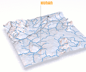 Places with similar names to Hunan, Myanmar ::
Disclaimer :: Information on this page comes without warranty of any kind |
||
|
Where is Hunan? Elevation and coordinates ::
Latitude (lat): 22°19'0"N Longitude (lon): 97°21'0"E
Elevation (approx.): 540m (map arrows pan, magnifying glasses zoom) |
||
|
Visiting Hunan? Hotel/Accommodation ::
Book a hotel in Hunan Travel Guide ::
Buy a travel guide for Myanmar rental cars ::
car rental offers GPS waypoint ::
download a GPX waypoint (PoI) of Hunan for your GPS receiver
|
||