|
search place name
|
||
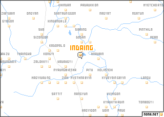
Indaing (Myanmar)Indaing is a town in Myanmar. An overview map of the region around Indaing is displayed below.
regional and 3d topo map of Indaing, Myanmar ::
Indaing airports ::
The nearest airport is HEH - Heho, located 177.0 km north of Indaing.
Nearby towns ::
Aunggyantha (1.9km north) //
Thayagon (3.7km north) //
Dodan (3.7km north) //
Hnawbin (3.5km east) //
Pitu (4.1km south east) //
Ngabat-in (4.1km north east) //
Wadawgyi (4.0km south west) //
Nyaungbintha (5.1km south west) //
Sibaing (5.6km north) //
Myethnabyin (5.6km south) //
Kadopalo (5.6km west) //
Yedashe (5.8km south) //
Kelinzeik (6.4km south east) //
Ziok (6.6km south west) //
Kongyi (7.0km west) //
Thabyedan (7.2km west) //
Ingyingon (7.2km west) //
Thapanzin (7.6km north) //
Hmanzi (7.2km west) //
Paukchaung (7.6km south west) //
Shwegazaung (8.2km north west) //
Kyweyaingbyin (8.9km south east) //
Kindangale (9.1km north west) //
Seinywa (8.9km south west) //
[all distances 'as the bird flies' and approximate]  Places with similar names to Indaing, Myanmar ::
// Inding (AT)
// Indian Neck (US)
// Indian Neck (US)
// Indanga (CD)
// Indonga (CD)
// Indang (ID)
// Ian-dong (KP)
// In-dong (KP)
// In-dong (KP)
// In-dong (KP)
Disclaimer :: Information on this page comes without warranty of any kind |
||
|
Where is Indaing? Elevation and coordinates ::
Latitude (lat): 19°12'0"N Longitude (lon): 96°22'0"E
Elevation (approx.): 59m (map arrows pan, magnifying glasses zoom) |
||
|
Visiting Indaing? Hotel/Accommodation ::
Book a hotel in Indaing Travel Guide ::
Buy a travel guide for Myanmar rental cars ::
car rental offers GPS waypoint ::
download a GPX waypoint (PoI) of Indaing for your GPS receiver
|
||