|
search place name
|
||
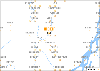
Indein (Sagaing, Myanmar)Indein is a town in the Sagaing region of Myanmar. An overview map of the region around Indein is displayed below.
regional and 3d topo map of Indein, Myanmar ::
Indein airports ::
The nearest airport is LSH - Lashio, located 196.4 km south east of Indein.
Other airports nearby include MYT - Myitkyina (209.0 km north east), Nearby towns ::
Lethagôn (0.0km north) //
Aledaw (1.7km east) //
Ingyingôn (1.7km east) //
Kanbauk (2.5km south west) //
Subokchaung (2.5km north east) //
Tanbingôn (3.7km south) //
Zibyugyin (3.7km north) //
Meza (3.9km south west) //
Sadwin (4.1km south east) //
Pyinzu (5.6km south) //
U-baw (5.6km north) //
Shweli (5.8km south) //
Nwagaya (6.3km south west) //
Myebalin (6.5km south west) //
Magyibin (6.8km west) //
Kwingyi (7.6km south) //
Paukkon (7.6km south) //
Petkagôn (7.6km north) //
Kinnge (7.5km north west) //
Konywa (7.5km south west) //
Paukpingwe (9.0km south west) //
Sagabin (9.0km north west) //
Peinnegôn (8.8km north west) //
[all distances 'as the bird flies' and approximate] 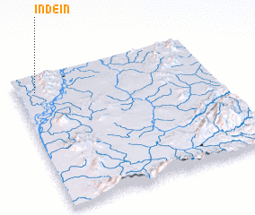 Places with similar names to Indein, Myanmar ::
Disclaimer :: Information on this page comes without warranty of any kind |
||
|
Where is Indein? Elevation and coordinates ::
Latitude (lat): 23°53'0"N Longitude (lon): 96°6'0"E
Elevation (approx.): 103m (map arrows pan, magnifying glasses zoom) |
||
|
Visiting Indein? Hotel/Accommodation ::
Book a hotel in Indein Travel Guide ::
Buy a travel guide for Myanmar rental cars ::
car rental offers GPS waypoint ::
download a GPX waypoint (PoI) of Indein for your GPS receiver
|
||