|
search place name
|
||
Ka-leng (Shan, Myanmar)Ka-leng is a town in the Shan region of Myanmar. An overview map of the region around Ka-leng is displayed below.
regional and 3d topo map of Ka-leng, Myanmar ::

Ka-leng airports ::
The nearest airport is HEH - Heho, located 91.5 km west of Ka-leng.
Other airports nearby include MOG - Mong Hsat (180.1 km east), MDL - Mandalay Intl (185.4 km north west), LSH - Lashio (215.8 km north), Nearby towns ::
Mai-pok (2.5km south east) //
Ka-ywi (2.5km south west) //
Wan Loi-lawk (5.1km south east) //
Makmo (5.1km north west) //
Nā-mo (5.6km south) //
Wān Yok (5.6km north) //
Kin-yum (5.5km west) //
Linkyawng (5.8km north) //
Kong-yong (6.9km west) //
Nā-lin (7.6km south) //
Hpa-yawng (7.6km south) //
Wān Ho (7.2km east) //
Wan Mwe-taw (7.2km west) //
Nawngmakmo (7.6km north) //
Namwawka (7.6km north) //
Namlin (7.6km north west) //
Napeng (8.2km south east) //
Hwè-hu (8.2km north west) //
Namhu (9.0km south east) //
Panghsi-nat (8.9km north west) //
Maklang-èk (10.1km south east) //
Namhu (10.1km north west) //
[all distances 'as the bird flies' and approximate] 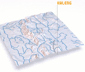 Places with similar names to Ka-leng, Myanmar ::
Disclaimer :: Information on this page comes without warranty of any kind |
||
|
Where is Ka-leng? Elevation and coordinates ::
Latitude (lat): 21°2'0"N Longitude (lon): 97°37'0"E
Elevation (approx.): 1458m (map arrows pan, magnifying glasses zoom) |
||
|
Visiting Ka-leng? Hotel/Accommodation ::
Book a hotel in Ka-leng Travel Guide ::
Buy a travel guide for Myanmar rental cars ::
car rental offers GPS waypoint ::
download a GPX waypoint (PoI) of Ka-leng for your GPS receiver
|
||