|
search place name
|
||
Kanbya (Sagaing, Myanmar)Kanbya is a town in the Sagaing region of Myanmar. An overview map of the region around Kanbya is displayed below.
regional and 3d topo map of Kanbya, Myanmar ::

Kanbya airports ::
The nearest airport is MDL - Mandalay Intl, located 105.4 km south east of Kanbya.
Other airports nearby include HEH - Heho (239.5 km south east), Nearby towns ::
Tawwe (0.0km north) //
Yinmagan (1.7km west) //
Aungtha (1.9km north) //
Tanbya (2.5km south west) //
Zidaw (2.5km north east) //
Kontha (2.5km north east) //
Pogon (3.4km west) //
Kyungyaung (3.7km north) //
Nabetha (3.7km south) //
Ywale (3.7km south) //
Kantha (4.1km north west) //
Thetshegan (3.9km north west) //
Yondaw (3.9km north west) //
Myobaw (3.9km south west) //
Minshwe (5.0km north west) //
Aunggyantha (5.0km north west) //
Moksogon (5.1km south east) //
Bawga (5.1km east) //
Thayettoyo (5.1km west) //
Magyi-ok (5.6km north) //
Gyogyagan (5.6km south) //
Tugyi (5.5km east) //
Kanthit (5.5km west) //
Mondu (5.5km east) //
Zidaw (5.5km west) //
Nyaungyeiktha (6.3km north west) //
Kyipadon (6.5km south west) //
Nebugon (6.5km north west) //
Anauktaw (7.1km west) //
[all distances 'as the bird flies' and approximate] 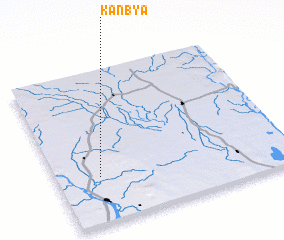 Places with similar names to Kanbya, Myanmar ::
Disclaimer :: Information on this page comes without warranty of any kind |
||
|
Where is Kanbya? Elevation and coordinates ::
Latitude (lat): 22°18'0"N Longitude (lon): 95°11'0"E
Elevation (approx.): 136m (map arrows pan, magnifying glasses zoom) |
||
|
Visiting Kanbya? Hotel/Accommodation ::
Book a hotel in Kanbya Travel Guide ::
Buy a travel guide for Myanmar rental cars ::
car rental offers GPS waypoint ::
download a GPX waypoint (PoI) of Kanbya for your GPS receiver
|
||