|
search place name
|
||
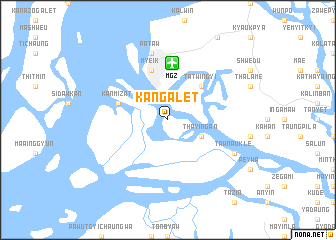
Kangalet (Myanmar)Kangalet is a town in Myanmar. An overview map of the region around Kangalet is displayed below.
regional and 3d topo map of Kangalet, Myanmar ::
Kangalet airports ::
The nearest airport is MGZ - Myeik, located 6.3 km north of Kangalet.
Other airports nearby include HHQ - Prachuap Khiri Khan Hua Hin (147.8 km east), BKK - Bangkok Intl (274.2 km north east), Nearby towns ::
 Places with similar names to Kangalet, Myanmar ::
// Gangalito (CU)
// Gañecoleta (ES)
// Conculito (GT)
// Kānī Kalāteh (IR)
// Kohneh Kalāt (IR)
// Caño Gallito (VE)
// Gangalada (NG)
// Gangalada (NG)
// Congolote (MZ)
// Kangulat (PG)
Disclaimer :: Information on this page comes without warranty of any kind |
||
|
Where is Kangalet? Elevation and coordinates ::
Latitude (lat): 12°23'0"N Longitude (lon): 98°37'0"E
Elevation (approx.): 8m (map arrows pan, magnifying glasses zoom) |
||
|
Visiting Kangalet? Hotel/Accommodation ::
Book a hotel in Kangalet Travel Guide ::
Buy a travel guide for Myanmar rental cars ::
car rental offers GPS waypoint ::
download a GPX waypoint (PoI) of Kangalet for your GPS receiver
|
||