|
search place name
|
||
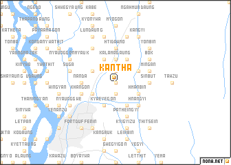
Kantha (Mandalay, Myanmar)Kantha is a town in the Mandalay region of Myanmar. An overview map of the region around Kantha is displayed below.
regional and 3d topo map of Kantha, Myanmar ::
Kantha airports ::
The nearest airport is MDL - Mandalay Intl, located 42.4 km south west of Kantha.
Other airports nearby include HEH - Heho (158.9 km south east), LSH - Lashio (194.2 km north east), Nearby towns ::
Magyibin (0.0km north) //
Patheingale (1.9km north) //
Kyaukthanbat (1.9km south) //
Kalamadaung (3.7km north) //
Taungda (4.1km north east) //
Ingyin (3.9km north east) //
Nyaungbintha (4.1km south east) //
Hmanbin (3.9km south east) //
Yontha (3.9km south east) //
Taungbyon (4.1km north west) //
Kyweyegon (4.1km south west) //
Kabaing (3.9km north west) //
Nandalamaing (3.9km south west) //
Hnangyi (5.1km south east) //
Sinbut (5.2km east) //
Htidawmo (5.6km north) //
Nanda (5.2km west) //
Mingan (5.5km east) //
Patheingyi (5.8km south) //
Khangon (5.5km west) //
Bok (6.3km north east) //
Thalunbyu (6.5km north west) //
Myothagon (7.6km south) //
Yedwet (7.6km south) //
Kyigyizu (7.6km south) //
Mothigon (7.6km south) //
Dahattaw (7.6km north) //
Suga (7.1km west) //
Sinywagale (7.1km west) //
[all distances 'as the bird flies' and approximate] 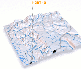 Places with similar names to Kantha, Myanmar ::
Disclaimer :: Information on this page comes without warranty of any kind |
||
|
Where is Kantha? Elevation and coordinates ::
Latitude (lat): 22°3'0"N Longitude (lon): 96°9'0"E
Elevation (approx.): 85m (map arrows pan, magnifying glasses zoom) |
||
|
Visiting Kantha? Hotel/Accommodation ::
Book a hotel in Kantha Travel Guide ::
Buy a travel guide for Myanmar rental cars ::
car rental offers GPS waypoint ::
download a GPX waypoint (PoI) of Kantha for your GPS receiver
|
||