|
search place name
|
||
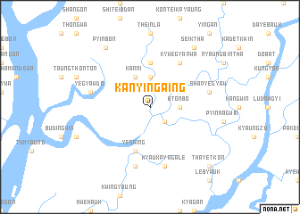
Kanyingaing (Ayeyarwady, Myanmar)Kanyingaing is a town in the Ayeyarwady region of Myanmar. An overview map of the region around Kanyingaing is displayed below.
regional and 3d topo map of Kanyingaing, Myanmar ::
Kanyingaing airports ::
The nearest airport is RGN - Yangon Intl, located 149.6 km east of Kanyingaing.
Nearby towns ::
Gangawgôn (2.6km south east) //
Theinla-gatsu (3.7km north) //
Htônbo (3.6km east) //
Kanni (4.1km north west) //
Theinla-saungbôn (5.6km north) //
Yesaing (5.8km south) //
Kywēgyanwa (6.6km north east) //
Kywegyantaung (6.6km north east) //
Yegyawdo (7.3km west) //
Tikogaing (7.6km south) //
Kyaukpyagale (7.6km south) //
Shanyegyaw (7.3km east) //
Seiktha (9.1km north east) //
Pyinbôn (9.1km north west) //
Thayetkôn (10.3km south east) //
[all distances 'as the bird flies' and approximate] 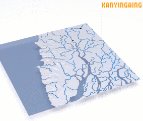 Places with similar names to Kanyingaing, Myanmar ::
// Kanyingaing (MM)
Disclaimer :: Information on this page comes without warranty of any kind |
||
|
Where is Kanyingaing? Elevation and coordinates ::
Latitude (lat): 16°24'0"N Longitude (lon): 94°50'0"E
Elevation (approx.): 6m (map arrows pan, magnifying glasses zoom) |
||
|
Visiting Kanyingaing? Hotel/Accommodation ::
Book a hotel in Kanyingaing Travel Guide ::
Buy a travel guide for Myanmar rental cars ::
car rental offers GPS waypoint ::
download a GPX waypoint (PoI) of Kanyingaing for your GPS receiver
|
||