|
search place name
|
||
Kawnghak (Shan, Myanmar)Kawnghak is a town in the Shan region of Myanmar. An overview map of the region around Kawnghak is displayed below.
regional and 3d topo map of Kawnghak, Myanmar ::

Kawnghak airports ::
The nearest airport is LSH - Lashio, located 77.8 km north of Kawnghak.
Other airports nearby include HEH - Heho (203.3 km south west), MDL - Mandalay Intl (205.4 km west), KET - Kengtung (212.8 km south east), MOG - Mong Hsat (243.0 km south east), Nearby towns ::
Hpak-bom (0.0km north) //
Hpak-pom (0.0km north) //
Na-mawn (2.5km south east) //
Namlin (5.0km north west) //
Kawnglen (5.1km east) //
Mān Maw (5.1km east) //
Nawngkwai (5.1km west) //
Pānglong (5.6km south) //
Nammawhsom (5.6km north) //
Namhu-un (5.5km east) //
Nampōk (5.8km north) //
Na-long (5.5km east) //
Hswe-hpu (5.5km east) //
Kanglong (6.5km south west) //
Nawng-mo (6.3km north west) //
Nammawn (6.9km west) //
Kong-mong (6.9km west) //
Kawngnim (7.6km south) //
Honghang (7.6km south east) //
Hang-yiu (7.6km south east) //
Pa-kang (7.8km south east) //
Angteung (9.0km south west) //
Yong-yang (8.8km south east) //
Sangwan (8.8km south west) //
Mān Kyawng (10.1km south west) //
[all distances 'as the bird flies' and approximate] 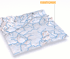 Places with similar names to Kawnghak, Myanmar ::
Disclaimer :: Information on this page comes without warranty of any kind |
||
|
Where is Kawnghak? Elevation and coordinates ::
Latitude (lat): 22°17'0"N Longitude (lon): 97°52'0"E
Elevation (approx.): 930m (map arrows pan, magnifying glasses zoom) |
||
|
Visiting Kawnghak? Hotel/Accommodation ::
Book a hotel in Kawnghak Travel Guide ::
Buy a travel guide for Myanmar rental cars ::
car rental offers GPS waypoint ::
download a GPX waypoint (PoI) of Kawnghak for your GPS receiver
|
||