|
search place name
|
||
Kēngtawng (Shan, Myanmar)Kēngtawng is a town in the Shan region of Myanmar. An overview map of the region around Kēngtawng is displayed below.
regional and 3d topo map of Kēngtawng, Myanmar ::

Kēngtawng airports ::
The nearest airport is MOG - Mong Hsat, located 104.2 km east of Kēngtawng.
Other airports nearby include HEH - Heho (170.2 km west), THL - Tachilek Tachileik (171.9 km east), KET - Kengtung (183.7 km north east), LPT - Lampang (247.4 km south east), Nearby towns ::
Nawnglum (1.7km west) //
Wān Kyawng (1.9km north) //
Wān Hkai-hpaknam (2.5km north east) //
Hwè-hok (3.7km south) //
Wān Kao-oi (3.9km south east) //
Wān Hwè-hke (5.1km north east) //
Hwè-saè (5.5km west) //
Tongsu (5.5km west) //
Wān Nawnghēng (6.4km south east) //
Nā-niu (6.4km south west) //
Wān Pa-lai (7.2km east) //
Pāngkeng (7.6km south west) //
Hwè-hèn (7.9km north east) //
Wān Wowsom (8.2km north east) //
Hwè-hsai (8.9km south east) //
Nā-hsin (9.1km north east) //
Hwè-nè (8.9km north west) //
[all distances 'as the bird flies' and approximate] 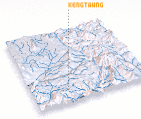 Places with similar names to Kēngtawng, Myanmar ::
// Cancadong (PH)
// Cangadieng (PH)
// Cang Atong (PH)
// Kaounga Dounga (CG)
// Gangtengah (ID)
// Kang-dong (KP)
// Kang-dong (KP)
// Kanggu-dong (KP)
// Kanggu-dong (KP)
// Kaong-dong (KP)
Disclaimer :: Information on this page comes without warranty of any kind |
||
|
Where is Kēngtawng? Elevation and coordinates ::
Latitude (lat): 20°12'0"N Longitude (lon): 98°19'0"E
Elevation (approx.): 722m (map arrows pan, magnifying glasses zoom) |
||
|
Visiting Kēngtawng? Hotel/Accommodation ::
Book a hotel in Kēngtawng Travel Guide ::
Buy a travel guide for Myanmar rental cars ::
car rental offers GPS waypoint ::
download a GPX waypoint (PoI) of Kēngtawng for your GPS receiver
|
||