|
search place name
|
||
Kio-ang (Shan, Myanmar)Kio-ang is a town in the Shan region of Myanmar. An overview map of the region around Kio-ang is displayed below.
regional and 3d topo map of Kio-ang, Myanmar ::

Kio-ang airports ::
The nearest airport is MDL - Mandalay Intl, located 93.8 km south west of Kio-ang.
Other airports nearby include LSH - Lashio (139.7 km north east), HEH - Heho (177.0 km south), Nearby towns ::
Kwangteng (2.5km south west) //
Kywe-det (2.5km south east) //
Ho-nanug (3.9km north east) //
Kawngmu (5.0km north east) //
Nattaung (5.1km west) //
Lukhsa-py-e (5.5km west) //
Ka-ru-hsan (5.8km north) //
Sitke-gon (6.3km south east) //
Me-haung (6.5km south east) //
Hkai-hpi-la (6.5km north east) //
Hsum Hsai (6.5km south east) //
Mi-nyankung (7.6km south east) //
Hsi-hsong (7.6km south west) //
Hkyawngka (8.2km north west) //
Nampa-lam (8.2km north east) //
Pangti (7.8km north east) //
Hkawngkyi (10.1km south west) //
Tha-pangyaung (10.1km south east) //
[all distances 'as the bird flies' and approximate] 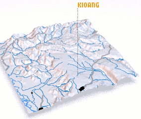 Places with similar names to Kio-ang, Myanmar ::
Disclaimer :: Information on this page comes without warranty of any kind |
||
|
Where is Kio-ang? Elevation and coordinates ::
Latitude (lat): 22°20'0"N Longitude (lon): 96°35'0"E
Elevation (approx.): 837m (map arrows pan, magnifying glasses zoom) |
||
|
Visiting Kio-ang? Hotel/Accommodation ::
Book a hotel in Kio-ang Travel Guide ::
Buy a travel guide for Myanmar rental cars ::
car rental offers GPS waypoint ::
download a GPX waypoint (PoI) of Kio-ang for your GPS receiver
|
||