|
search place name
|
||
Kun-hio (Shan, Myanmar)Kun-hio is a town in the Shan region of Myanmar. An overview map of the region around Kun-hio is displayed below.
regional and 3d topo map of Kun-hio, Myanmar ::

Kun-hio airports ::
The nearest airport is LSH - Lashio, located 31.3 km north west of Kun-hio.
Other airports nearby include MDL - Mandalay Intl (232.6 km south west), KET - Kengtung (238.0 km south east), Nearby towns ::
Nā-ya (0.0km north) //
Hwè-lü (1.9km south) //
Hapa-palang (1.9km north) //
Nā-hsang (1.7km east) //
Kawng-sam (2.5km south west) //
Kong-söng (2.5km north west) //
Na-sawk (2.5km south east) //
Kawng-hka (3.7km south) //
Ho-hkong (3.4km east) //
Nawnghpakkut (3.9km north east) //
Kunghkam (3.9km south east) //
Nam-hu-kyeng (5.0km north west) //
Ping-long (5.0km north west) //
Pāng-leng (5.6km north) //
Long-hawm (5.8km north) //
Nam-hkum-hpa (5.5km west) //
Kong-pao (6.3km north west) //
Kong-nio (6.5km south west) //
Mān-wing (6.5km north west) //
Hpa-so (6.5km north west) //
Nampawng (6.8km west) //
Möng-pai (7.4km north) //
Kawng-ke (7.1km west) //
Nā-tawn (7.1km west) //
Kawn-heo (7.1km west) //
Loi-hkan (7.1km east) //
Mān Kyawng (7.6km north) //
Nā-leng (7.6km north) //
Mān Se (7.6km north west) //
[all distances 'as the bird flies' and approximate] 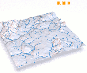 Places with similar names to Kun-hio, Myanmar ::
Disclaimer :: Information on this page comes without warranty of any kind |
||
|
Where is Kun-hio? Elevation and coordinates ::
Latitude (lat): 22°45'0"N Longitude (lon): 97°56'0"E
Elevation (approx.): 665m (map arrows pan, magnifying glasses zoom) |
||
|
Visiting Kun-hio? Hotel/Accommodation ::
Book a hotel in Kun-hio Travel Guide ::
Buy a travel guide for Myanmar rental cars ::
car rental offers GPS waypoint ::
download a GPX waypoint (PoI) of Kun-hio for your GPS receiver
|
||