|
search place name
|
||
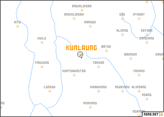
Kunlaung (Chin, Myanmar)Kunlaung is a town in the Chin region of Myanmar. An overview map of the region around Kunlaung is displayed below.
regional and 3d topo map of Kunlaung, Myanmar ::
Kunlaung airports ::
The nearest airport is AKY - Sittwe, located 141.7 km south west of Kunlaung.
Other airports nearby include CXB - Cox's Bazar Coxs Bazar (168.0 km west), KYP - Kyaukpyu (200.1 km south), CGP - Chittagong Shah Amanat Intl (213.5 km north west), Nearby towns ::
Yapkon (3.9km south east) //
Kumtsawngtsa (4.1km south west) //
Batwe (5.5km east) //
Rapdok (7.6km north) //
Kaibwi-imnu (8.2km south east) //
Lungdu (10.1km south west) //
[all distances 'as the bird flies' and approximate]  Places with similar names to Kunlaung, Myanmar ::
// Canlinga (PH)
// Canlung (PH)
// Canoling (PH)
// Kanlingo (PH)
// Kanoling (PH)
// Kanoling (PH)
// Kanalenga (CD)
// Cannalonga (IT)
// Kan-lin-kou (TW)
// Qinling (CN)
Disclaimer :: Information on this page comes without warranty of any kind |
||
|
Where is Kunlaung? Elevation and coordinates ::
Latitude (lat): 21°14'0"N Longitude (lon): 93°34'0"E
Elevation (approx.): 830m (map arrows pan, magnifying glasses zoom) |
||
|
Visiting Kunlaung? Hotel/Accommodation ::
Book a hotel in Kunlaung Travel Guide ::
Buy a travel guide for Myanmar rental cars ::
car rental offers GPS waypoint ::
download a GPX waypoint (PoI) of Kunlaung for your GPS receiver
|
||