|
search place name
|
||
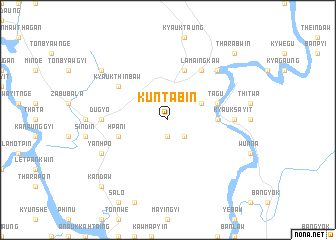
Kuntabin (Myanmar)Kuntabin is a town in Myanmar. An overview map of the region around Kuntabin is displayed below.
regional and 3d topo map of Kuntabin, Myanmar ::
Kuntabin airports ::
The nearest airport is MGZ - Myeik, located 47.1 km north west of Kuntabin.
Other airports nearby include HHQ - Prachuap Khiri Khan Hua Hin (112.6 km north east), BKK - Bangkok Intl (254.7 km north east), Nearby towns ::
Thittat (1.9km south) //
Kyaukpyu (2.6km south east) //
Tagu (4.1km north east) //
Mayingyi (5.4km east) //
Hpani (5.7km west) //
Tagu (5.7km east) //
Anachaung (5.8km north) //
Lamaingkaw (6.6km north east) //
Kyaukthinbaw (6.6km north west) //
Kyauksayit (7.2km east) //
Dugyo (7.2km west) //
Tharabwin West (7.8km north east) //
Yanhpo (8.1km south west) //
Ngayanin (9.1km north west) //
Banlamut (10.4km south west) //
Kandaw (10.4km south west) //
Tharabwin (10.4km north east) //
[all distances 'as the bird flies' and approximate]  Places with similar names to Kuntabin, Myanmar ::
// Cantabon (PH)
// Cantoba-on (PH)
// Kandybino (UA)
// Kāntābunia (BD)
// Kuantabun (TP)
// Kandbon (IR)
// Kand-e Bon (IR)
// Kandeh Beyn (IR)
// Quindebana (CO)
// Cantebonne (FR)
Disclaimer :: Information on this page comes without warranty of any kind |
||
|
Where is Kuntabin? Elevation and coordinates ::
Latitude (lat): 12°14'0"N Longitude (lon): 99°0'0"E
Elevation (approx.): 68m (map arrows pan, magnifying glasses zoom) |
||
|
Visiting Kuntabin? Hotel/Accommodation ::
Book a hotel in Kuntabin Travel Guide ::
Buy a travel guide for Myanmar rental cars ::
car rental offers GPS waypoint ::
download a GPX waypoint (PoI) of Kuntabin for your GPS receiver
|
||