|
search place name
|
||
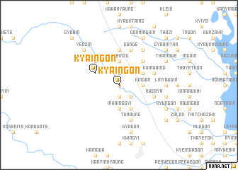
Kya-ingon (Myanmar)Kya-ingon is a town in Myanmar. An overview map of the region around Kya-ingon is displayed below.
regional and 3d topo map of Kya-ingon, Myanmar ::
Kya-ingon airports ::
The nearest airport is RGN - Yangon Intl, located 161.7 km south of Kya-ingon.
Nearby towns ::
Sinzeik (0.0km north) //
Sinzeik (1.9km south) //
Hmyinbin (1.9km north) //
Sinzalok (2.6km south east) //
Momaka (2.6km south east) //
Dawmagwin (3.5km east) //
Kindan (3.5km east) //
Inwainggyi (3.7km south) //
Thayetsein (3.7km south) //
Le-einzu (3.7km north) //
Shanzu (3.7km north) //
Migyaung-aing (3.7km north) //
Gonde (4.1km south east) //
Kanyutkwin (4.0km north east) //
Nganuthan (4.0km north east) //
Kya-ingon (4.0km north west) //
Seiktangin (5.1km north east) //
Minlangu (5.1km north west) //
Minlangu-shanzu (5.1km north west) //
Pattan (5.6km north) //
Kwebya (5.6km east) //
Gonde (5.8km north) //
Tumaung (5.8km south) //
Kwinwaing (5.6km east) //
Zibyugin (6.6km north east) //
Linyawgin (7.0km east) //
Sobongwin (7.0km east) //
Myetnigwin (7.3km east) //
Gyogon (7.6km south) //
[all distances 'as the bird flies' and approximate]  Places with similar names to Kya-ingon, Myanmar ::
// Caayongan (PH)
// Guyangan (ID)
// Guyangan (ID)
// Guyangan (ID)
// Guyangan (ID)
// Guyangan (ID)
// Guyangan (ID)
// Kayan Keyna (NE)
// Kaehyŏng-ni (KP)
// Kayang-ni (KP)
Disclaimer :: Information on this page comes without warranty of any kind |
||
|
Where is Kya-ingon? Elevation and coordinates ::
Latitude (lat): 18°20'0"N Longitude (lon): 96°28'0"E
Elevation (approx.): 35m (map arrows pan, magnifying glasses zoom) |
||
|
Visiting Kya-ingon? Hotel/Accommodation ::
Book a hotel in Kya-ingon Travel Guide ::
Buy a travel guide for Myanmar rental cars ::
car rental offers GPS waypoint ::
download a GPX waypoint (PoI) of Kya-ingon for your GPS receiver
|
||