|
search place name
|
||
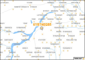
Kyathegan (Mandalay, Myanmar)Kyathegan is a town in the Mandalay region of Myanmar. An overview map of the region around Kyathegan is displayed below.
regional and 3d topo map of Kyathegan, Myanmar ::
Kyathegan airports ::
The nearest airport is MDL - Mandalay Intl, located 43.3 km north of Kyathegan.
Other airports nearby include HEH - Heho (99.6 km south east), LSH - Lashio (254.3 km north east), Nearby towns ::
Thakutmyin (1.9km south) //
Kywedat (3.7km north) //
Pwezongon (3.5km east) //
Yewe (5.1km north west) //
Shweku (5.1km north east) //
Shwedaung (5.1km south west) //
Letpanzeik (5.6km north) //
Zibyuchan (5.6km north) //
Kyutkan (5.6km south) //
Sipin (5.8km north) //
Hteingangyi (5.8km south) //
Thanatkhadaw (6.5km south east) //
Nwashayo (7.4km north) //
Taungkaing (6.9km east) //
Ywatha (7.6km north) //
Byingyi (7.6km north) //
Ywathit (7.2km east) //
Myaukkaing (7.2km east) //
Yewe (7.2km west) //
Taunggyi (7.2km west) //
Pakan (7.2km east) //
Sinchidaing (7.6km north east) //
Chinthelet (7.6km south east) //
Thalun (7.8km north east) //
Nyaungbinywa (7.8km south east) //
Kongyi (7.8km south west) //
Sadaung (9.0km north east) //
Tanbingon (9.0km south east) //
Thabyedaung (8.9km south east) //
[all distances 'as the bird flies' and approximate]  Places with similar names to Kyathegan, Myanmar ::
// Kyethigon (MM)
Disclaimer :: Information on this page comes without warranty of any kind |
||
|
Where is Kyathegan? Elevation and coordinates ::
Latitude (lat): 21°19'0"N Longitude (lon): 96°3'0"E
Elevation (approx.): 107m (map arrows pan, magnifying glasses zoom) |
||
|
Visiting Kyathegan? Hotel/Accommodation ::
Book a hotel in Kyathegan Travel Guide ::
Buy a travel guide for Myanmar rental cars ::
car rental offers GPS waypoint ::
download a GPX waypoint (PoI) of Kyathegan for your GPS receiver
|
||